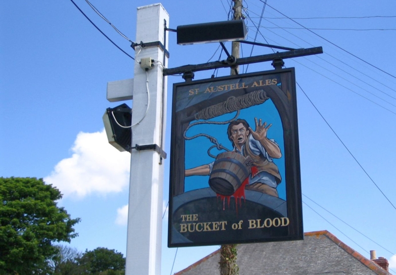
Hayle to Holywell Bay (1)
Hayle Harbour
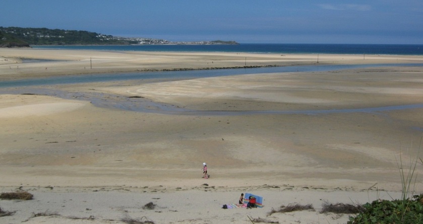
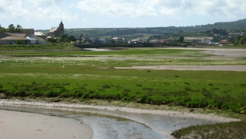
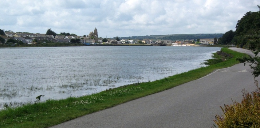
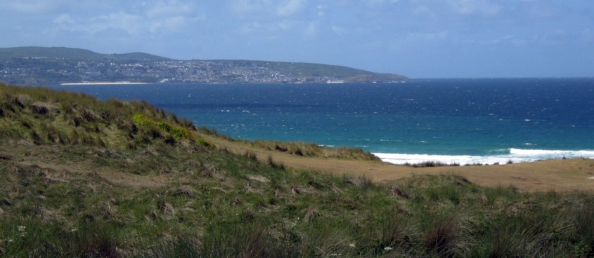
The Hayle River flows to the sea between Porth Kidney Sands, top left, and Hayle Towans beach, foreground. St Ives is in the distance. 30.07.2011.
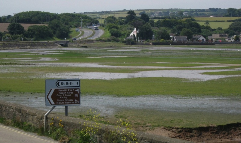
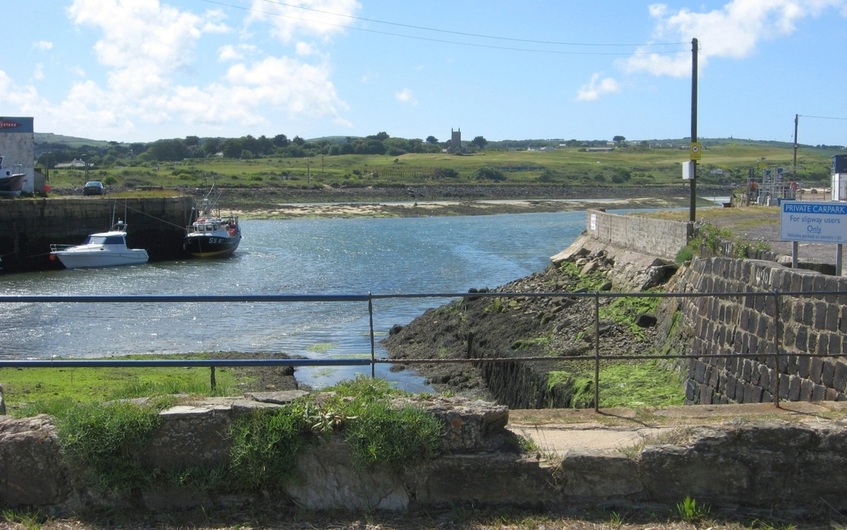
Hayle Harbour is a shallow natural harbour, formed where several streams join together and make their way to the sea through the sands of St Ives Bay. It was once more extensive, but reclamation and natural silting have reduced its size. St Erth in the south was once at the lowest crossing point of the River Hayle, but travellers between St Just or St Ives, and the east of the county, found this a long detour south. Some brave souls would attempt to cross the sands of the estuary at low tide, but that was a risky business, so in 1825 a causeway was built across the harbour to the north of St Erth. The part of the harbour to the north of the causeway is called Lelant Saltings after the village on its north shore, and we'll look at this first, starting in the SW at Griggs Quay.
The Causeway, left, crosses the Hayle River by the bridge. Centre is the The Old Quay House pub and restaurant. 04.07.2011.
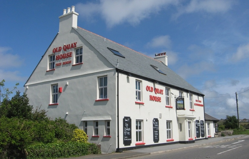
The Old Quay makes a nice beer garden for the pub, but you'd struggle to get a rowing boat up here now, even though it's close to the channel!
Lelant village from The Causeway. The railway from St Ives to St Erth runs above the shore, in front of the houses. 04.07.2011
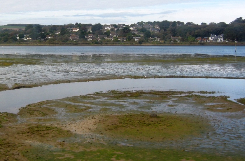
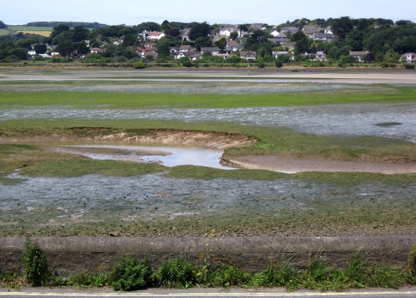
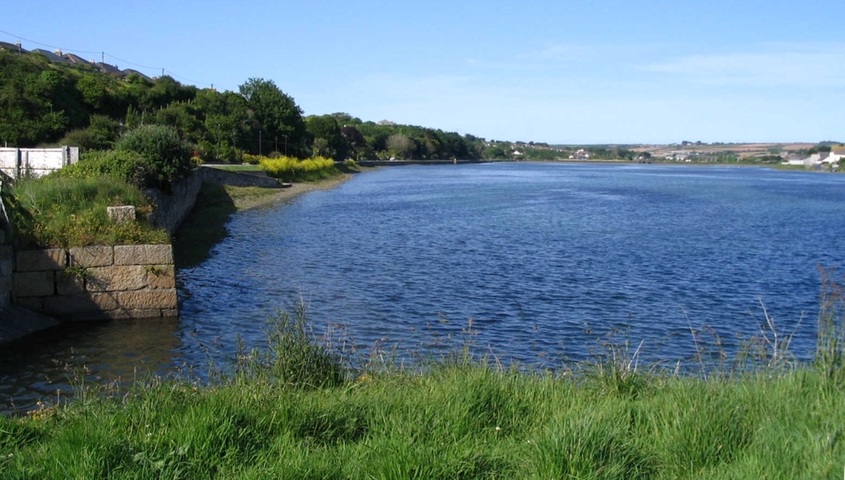
Lelant saltings, not long after high water. 04.10.2011.
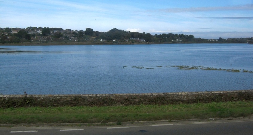
Lelant Saltings at High Tide. 04.10.2011.
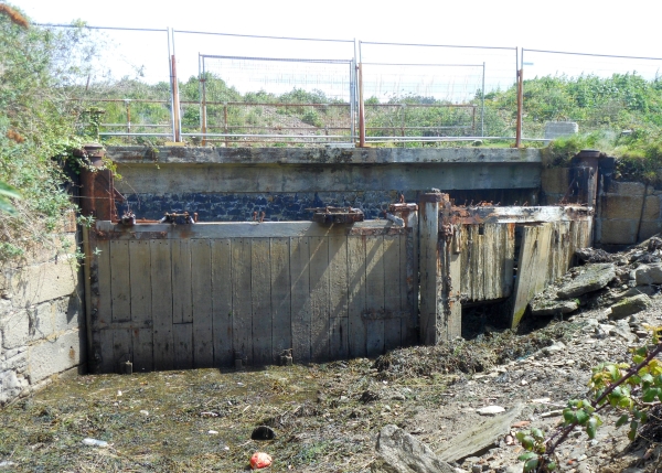
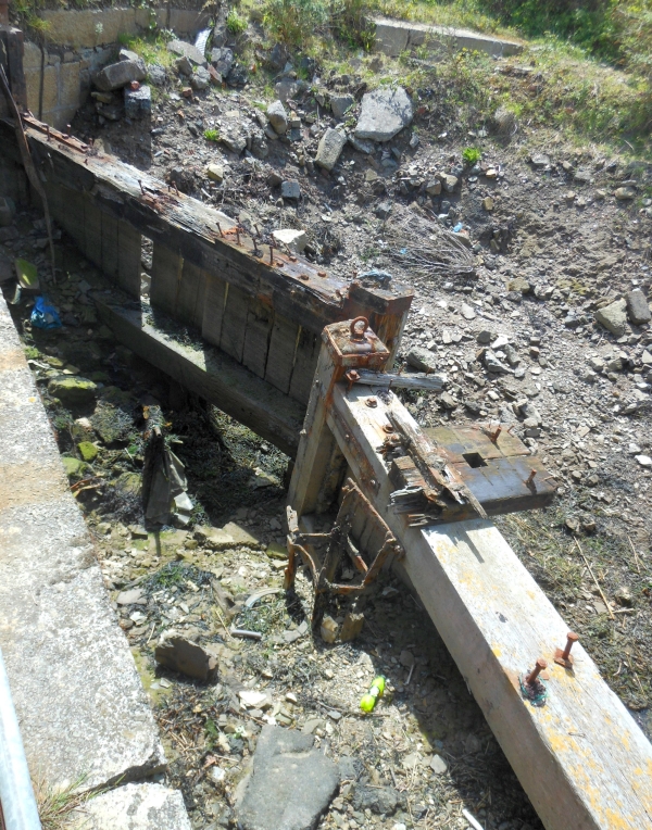
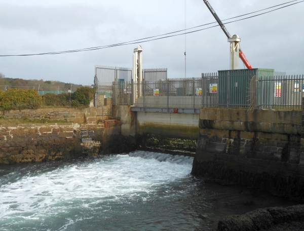
Part of Lelant saltings, near Hayle, was enclosed to form Carnsew Dock, known later as Carnsew Pool, when its main purpose was to hold back water to flush the harbour channels at low tide. The Sluice Gates still exist, although in a bad state of repair, but are now cut off from the pool itself.
|
|
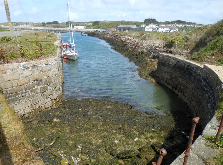
This is the channel the water from the sluices would have followed to the main harbour. (Carnsew sluice photos: 15.05.2013.)
The photos below show the culverts that link Carnsew Pool to the rest of Hayle harbour:
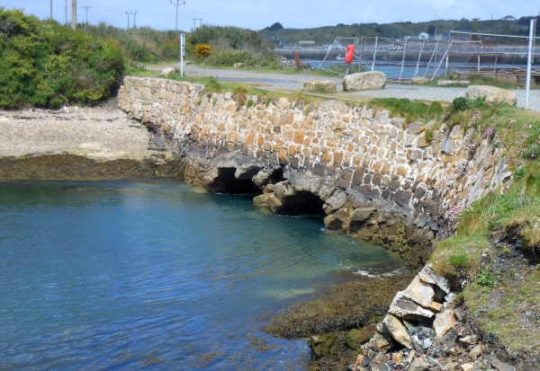
Just after high water - the tidal flow is already obvious...
|
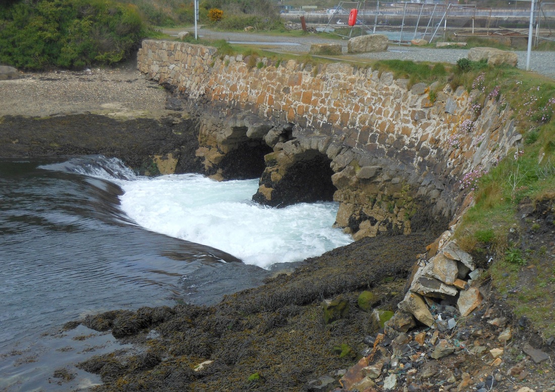
One hour later - the water is gushing out as the tide falls.
|
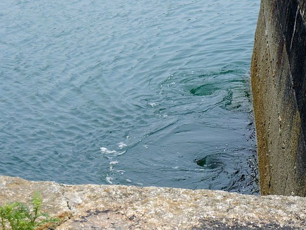
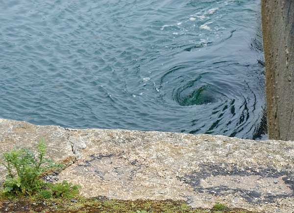
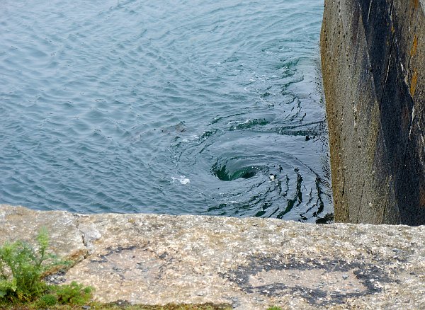
On a flood tide, towards high water, so much water is being pushed through the 40-foot long culverts into the Pool that large and dangerous whirlpools are created in the main harbour where the water descends. These whirlpools form even on Neap tides, but they are wider, deeper and longer-lasting on Spring tides.
|
|
|
The three photos above were taken about an hour before High Water Neaps. (19.06.2013.)
2015:
Much has happened in Hayle since I started this website, including the building of a futuristic ASDA on the once derelict South Quay. I've ignored this here as it isn't relevent to my tidal theme. But nearby the old Carnsew Pool sluice gates (as shown above) have recently been removed, and the sluice channel from the Pool has been cleared. The plan is to install replica sluice gates to replace the old ones...
(Photo dates: 26.01.2015 & 9.02.2015.)
View NE from Carnsew Pool. Middle distance shows the Sluice channel passing under a new concrete bridge, and beyond that,
on the east side of the channel, the car park of the new ASDA. In the distance, Penpol Terrace, with St Elwyn's church beyond.
on the east side of the channel, the car park of the new ASDA. In the distance, Penpol Terrace, with St Elwyn's church beyond.
The old, original, sluice gates.
|
9.02.2015: New sluice gates awaiting installation.
|
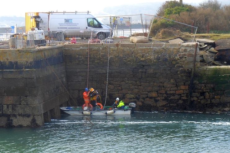
Meanwhile, approaching low tide, an underwater inspection of the culverts from Carnsew Pool is underway.
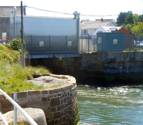
Saturday 11. 04. 2015: Within the last two days, the new Sluice Gates have been put in place.
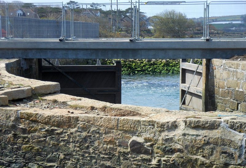
View under the bridge over the Sluice channel. The south gate is in the closed position, the north gate is open.
When the installation is complete, both gates will mostly remain closed, and the two sluices in each one will control the water flow.
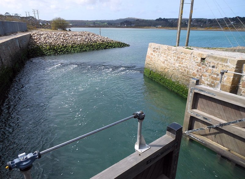
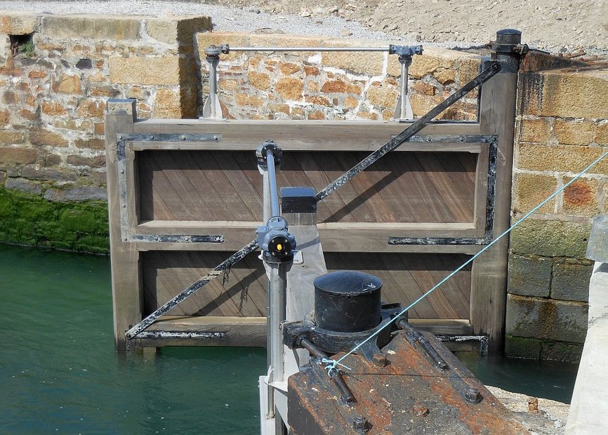
On the ebb, water flows out of Carnsew Pool into the sluice channel. The gear on top of each gate controls the raising of the sluice gates.
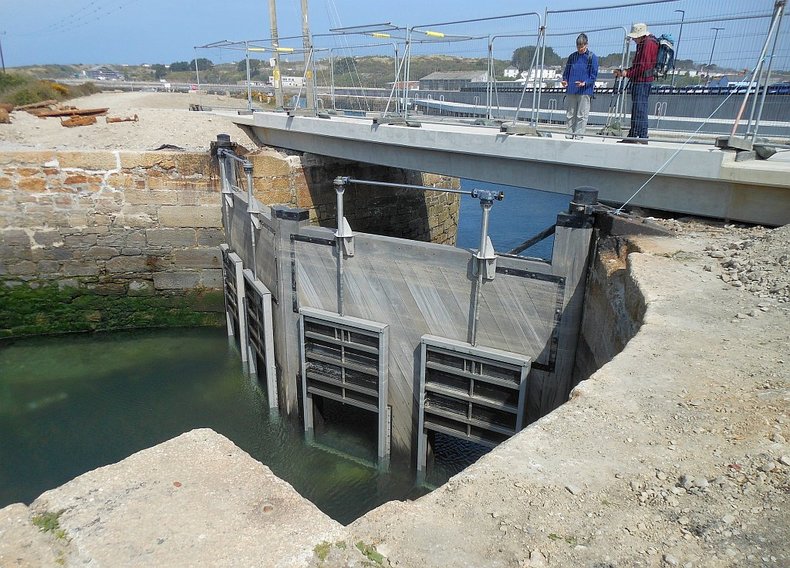
23. 04. 2015. Both Gates closed, all sluices open. (Note tidemarks on gates.)
We'll leave Carnsew Pool and the saltings now to explore the rest of Hayle Harbour.
Once an incoming vessel has left the channel across the sands of St Ives Bay,
and come within the land proper, St Uny church at Lelant to starboard is a prominent landmark.
Once an incoming vessel has left the channel across the sands of St Ives Bay,
and come within the land proper, St Uny church at Lelant to starboard is a prominent landmark.
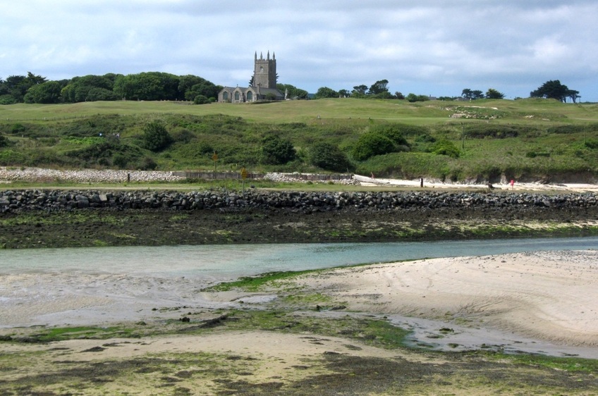
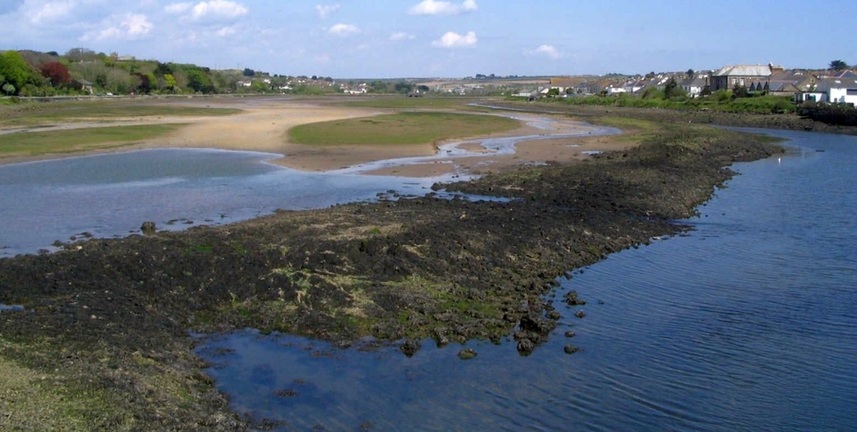
Lelant church: about here, the channel divides. To starboard it continues into the saltings, but we'll look now at the easterly branch. 20.07.2011.
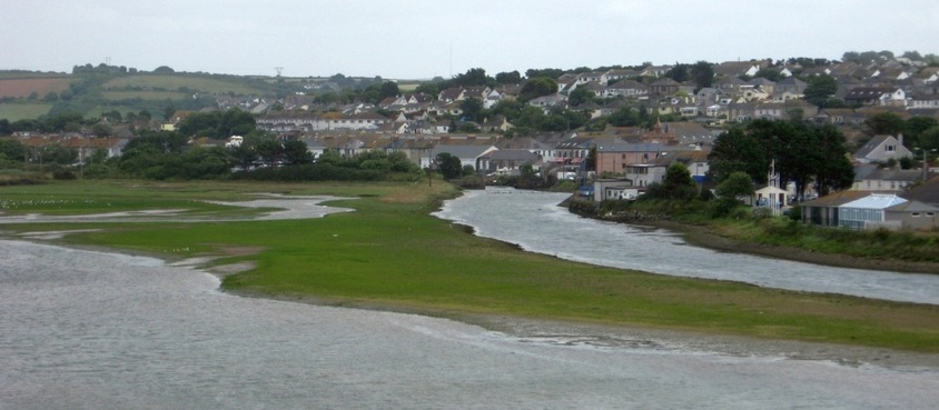
A little further in, the channel divides again, around a middle ground called Cockle Bank.
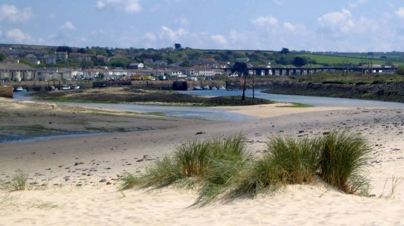
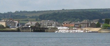
Centre is Cockle Bank. On the right, the channel that used to serve Carnsew Dock runs to the west of South Quay. 31.05.2005.
View south from North Quay. Cockle Bank and the Carnsew channel is on the right. Copperhouse Creek branches off to the left, behind the moored yacht.
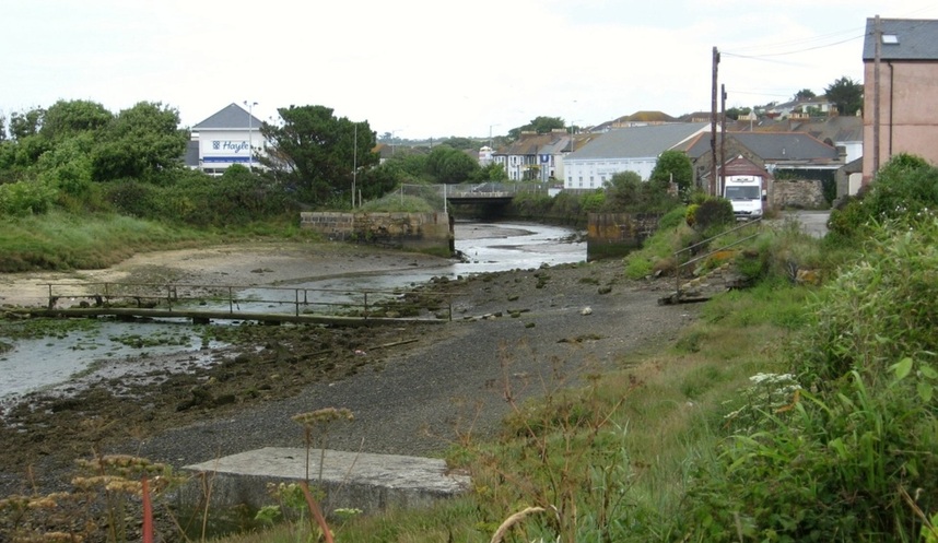
In the centre, the channel curves around between East Quay (L), and South Quay (R) to become Penpol Creek,
which reaches almost to the railway viaduct. Much of Penpol Creek dries, and it is used mostly by small craft.
which reaches almost to the railway viaduct. Much of Penpol Creek dries, and it is used mostly by small craft.
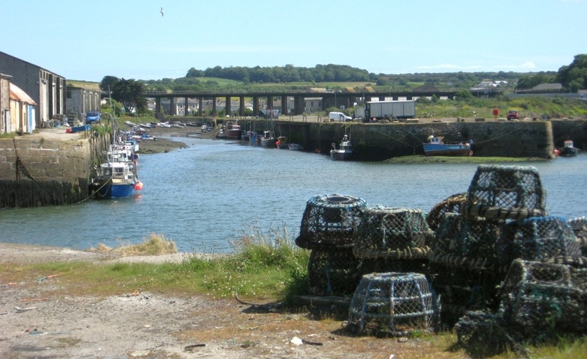
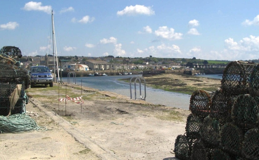
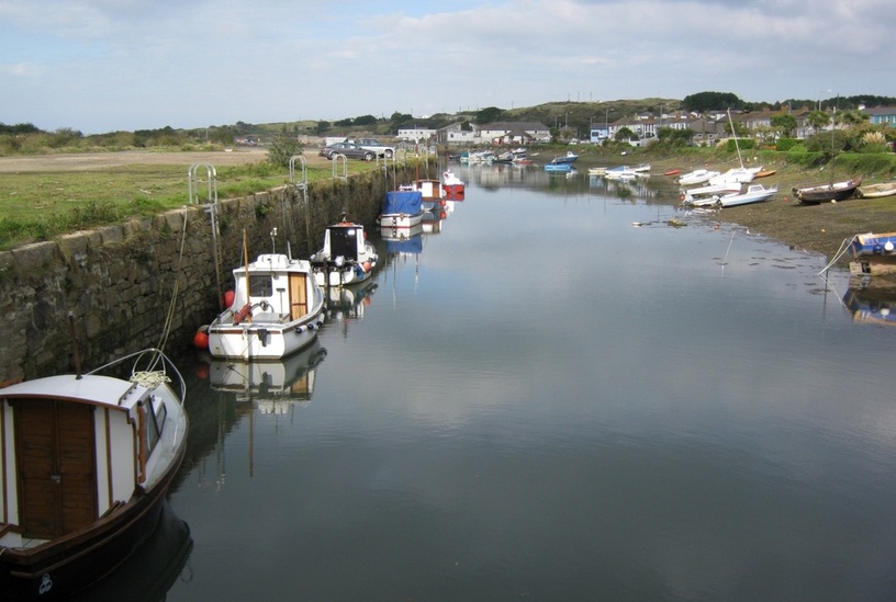
Penpol Creek. Harvey's Foundry, which once built the world's biggest steam engines, was located behind the railway viaduct. 19.06.2008.
This local boatowner left it a little late on a falling tide to get back to his berth in Penpol Creek! 19.08.2011.
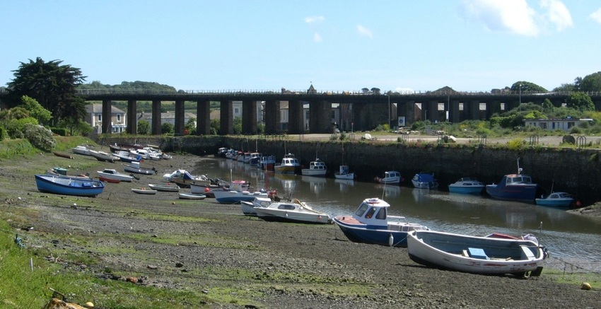
The railway viaduct, and the upper end of Penpol Creek at low water. 19.06.2008.
A view north from the end of Penpol Creek, at about half-tide. In the distance are the sand dunes of Hayle Towans. 14.10.2009.
Hayle has a fascinating history. The presence of so many quays tells us that this was once a busy port, and there was heavy industry here in the height of the mining period. As a picture board alongside Penpol Creek modestly claims, this was the Birthplace of the Industrial Revolution!
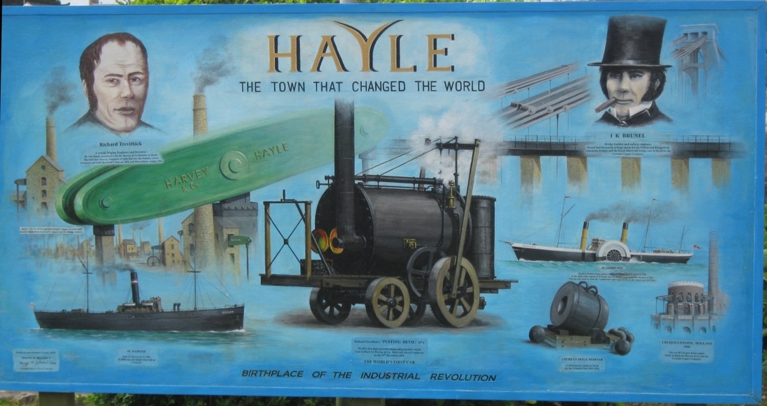
CLICK IMAGE FOR MORE DETAIL. Photo: 19.08.2011.
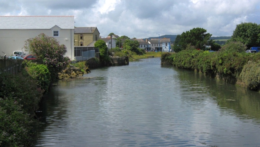
Harvey and Co. came into control of Penpol Creek and Carnsew Dock, but an earlier industrial concern, the Cornish Copper Company (CCC), already had control of the last arm of Hayle Harbour, Copperhouse Creek, which runs roughly NE from Hayle. They operated a succesful copper smelter at Ventonleague, and had a canal dug along the south side of the creek so that barges could access the quays. Parts of the upper creek were filled in, and much of the rest was enclosed. This area is now generally called Copperhouse Pool, and barges would enter it via lock gates.
Copperhouse Creek joins the lower part of the harbour here, between East Quay (L) and North Quay (near R). 19.06.2008.
Since this picture was taken, North Quay has undergone serious reconstruction, and the quay walls have been repaired or rebuilt. The little culvert at the bottom of the picture was the outlet for North Sluice. North sluice could be opened to let the water impounded in Copperhouse Pool rush out as a way of flushing sand and silt clear of the channels, much as happened with Carnsew Pool. The use of the sluice gates ceased in 1971. In 2011 they were rediscovered, buried near the harbour office. Thought to date from 1834, in March 2013 they were put on display in King George V Memorial Walk (KGVMW) gardens, on the north side of Copperhouse Pool.
Nowadays, the flow of the tide in and out of the pool can be controlled by raising or lowering this tide gate. 19.06.2008.
Ebb tide: ^ Gate nearly closed: 14.02.2012. ^ ... > Fully open: 25.07.2012 >
|
|
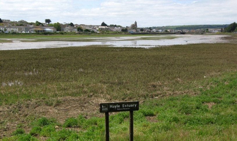
The tide gate is positioned where the old lock gates used to be. The tide only starts to enter the pool at about half tide in the harbour outside, but then it can rush in at quite a rate, rapidly covering the mud and sand flats. Copperhouse Pool is now a nature reserve, supervised by the RSPB.
The deeper water (R) is the old canal. All of this will covered at high water, rocks and all. But there's no boating activity now. 31.05.2005.
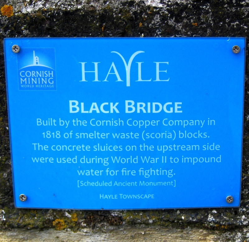
The shoreline to the left is KGVMW. Centre-top is Black Bridge, which crosses one of the two streams that flow into the Pool.
The other stream flows into the canal basin, out of sight in this shot.
The other stream flows into the canal basin, out of sight in this shot.
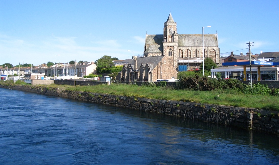
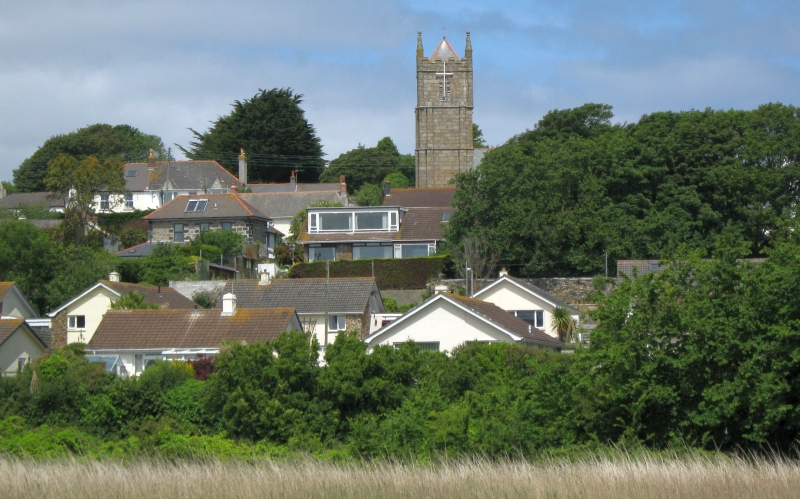
The south bank of the pool, as a strong spring tide rushes in. St Elwyn's Church glows in the June afternoon sun. 17.06.2005.
This quayside used to be known as Merchant Curnow's Quay.
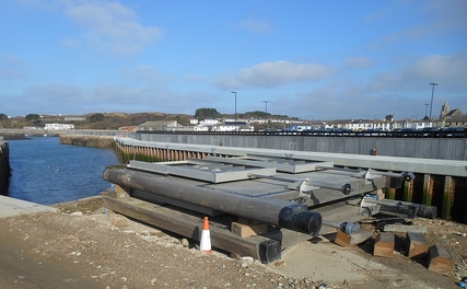
The last two photos, and the next one, couldn't be replicated now. They were taken from an old iron swing bridge (a listed building), just east of the Tide Gate. Originally this gave road and rail access to North Quay. But along with the North Quay renovation a new reinforced concrete bridge across Copperhouse Pool was built, bypassing the old bridge, which is now for pedestrians only. The new bridge, completed in 2012, comes ashore on the south bank just opposite the garage there, blocking off much of this view.
I have a separate website that documents the building of the Jubilee Bridge,
(as it's now called) in photographs. It covers the period July 2011 to January 2013.
(as it's now called) in photographs. It covers the period July 2011 to January 2013.
Although there's no boating activity allowed now, I have seen a photo, early 20th C, showing a sailing regatta here at High Water! 12.06.2005.
A zoomed shot from up on Clifton Terrace shows the point where the canal entered the basin at the copper smelting works. 28.06.2008
A closer view of the canal basin. Hayle Co-op hides behind the trees, on about the same spot where the CCC smelter was once sited. 28.06.2008.
The little footbridge in the foreground enables walkers to cross the stream when the tide is 'out' - as it usually is!
(In the previous photo, the bridge can be seen partially covered by the tide.)
(In the previous photo, the bridge can be seen partially covered by the tide.)
Copperhouse canal basin from the "Co-op bridge". 09.07.2011.
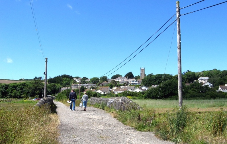
A track leads NW from the Co-op across Black Bridge, towards Phillack. 19.06.2008.
|
09.07.2011.
|
Before the bridge and road was built, the estuary would have extended further east.
The view SW from Black Bridge at low water. St Elwyn's church is a notable landmark. 19.06.2008.
There was a church at Phillack long before Hayle town got started. 06.06.2011.
|
Not far from the church, the local pub... 31.05.2005.
|
Returning to Hayle via KGVMW offers these views of Copperhouse Pool... 06.06.2011.
|
|
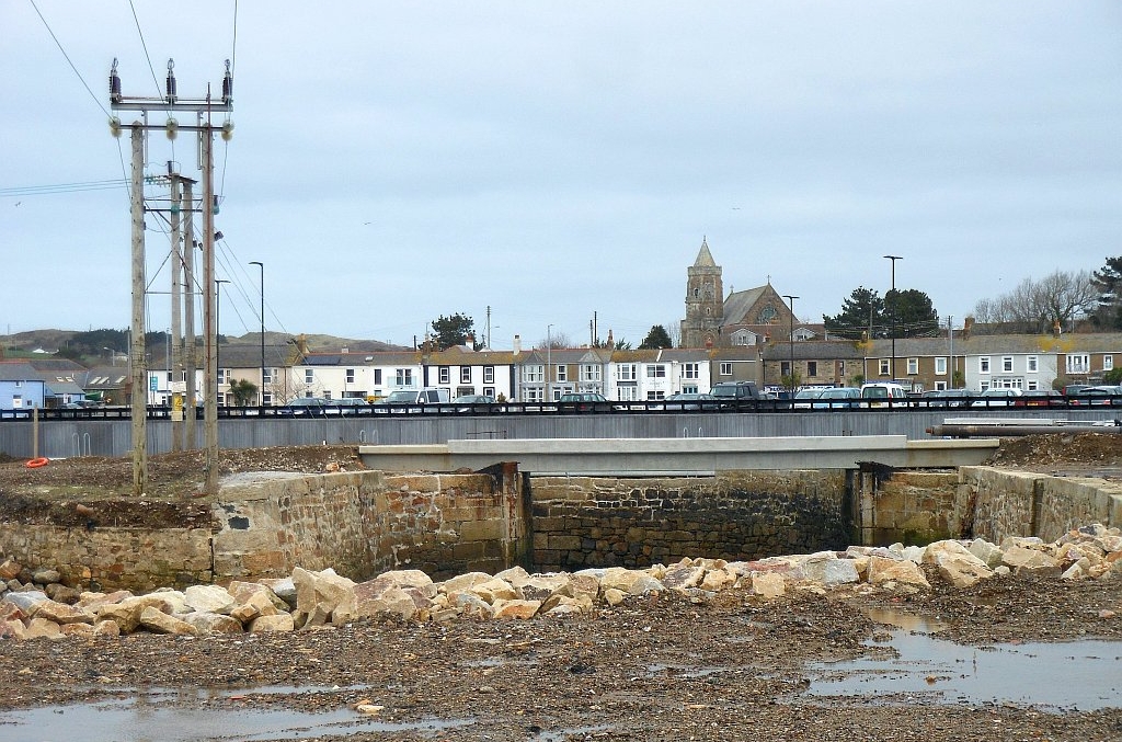
We've already mentioned the old iron swing-bridge that carried the road and railway over the Pool near the old locks. The Hayle Railway was at first a mineral tramway which operated from 1837. After crossing the old iron bridge, the railway followed the north side of Copperhouse Pool. Just east of the pool, a newly (2013) renovated footpath continues along the route of the line, crossing a stream by the oldest standard gauge bridge in Cornwall. The Hayle Railway was taken over by the West Cornwall Railway in 1846, which had plans to extend it at both ends, to Penzance and Truro. After various problems, the new line was finally opened in 1852.
King George V Memorial Walk follows the route of the old line along the north side of the Pool. (The present day main line railway runs through Hayle and Copperhouse.) The land at Undercliff was purchased in 1936 by Phillack East Urban District Council from the Great Western Railway Company and Messrs. Harvey and Company. It was laid out as a formal Walk to commemorate the Silver Jubilee of King George V and Queen Mary. Later it was taken over by Hayle Town Council.
King George V Memorial Walk follows the route of the old line along the north side of the Pool. (The present day main line railway runs through Hayle and Copperhouse.) The land at Undercliff was purchased in 1936 by Phillack East Urban District Council from the Great Western Railway Company and Messrs. Harvey and Company. It was laid out as a formal Walk to commemorate the Silver Jubilee of King George V and Queen Mary. Later it was taken over by Hayle Town Council.
The SW part of Copperhouse Pool at high Water. The date is 09.09.2011, and work has recently begun on building the new bridge...
|
Left of centre is the old iron swing bridge. The white bags contain gravel and other materials to construct a temporary causeway right across the Pool. For the full story of the bridge construction, see my other website, The Jubilee Bridge. |
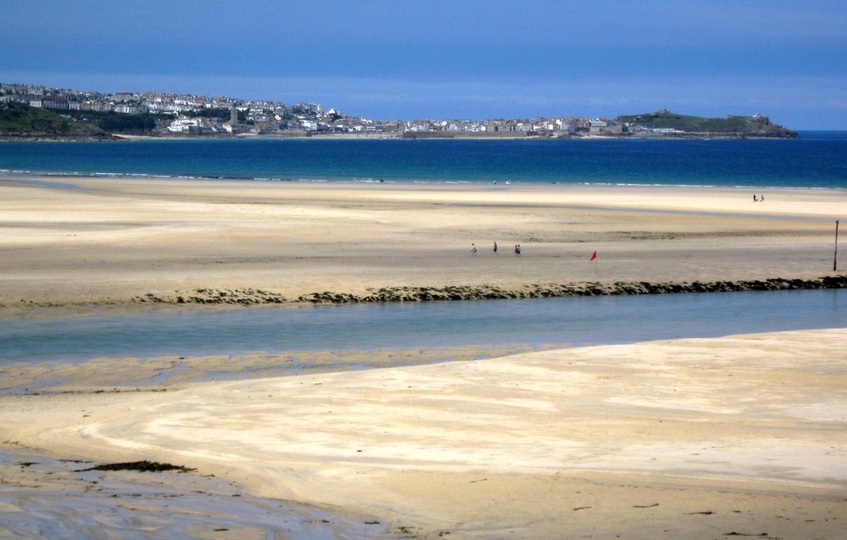
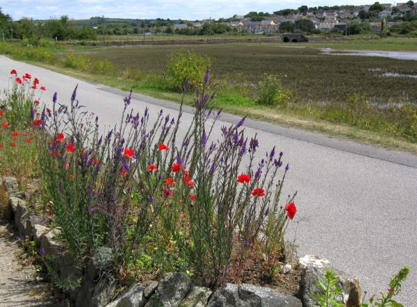
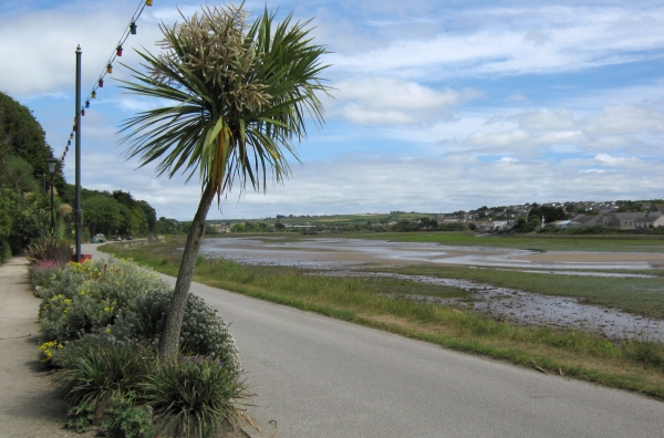
We return to the coast, where the Hayle river meets the sea. From here to Godrevy Point, 3 miles NE, there are wide and sandy beaches. 30.07.2011.
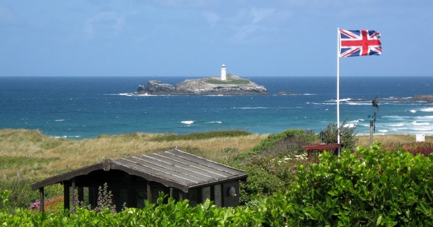
Godrevy Island, with its Lighthouse, seen from Hayle Towans beach. 30.07.2011.
The extent of the sands on this coast (especially at low tide) means that centuries of strong onshore winds have built up big sand dunes behind the beaches. These are known locally as Towans, a distictive part of the marine environment. They are often just rolling areas of grass, threaded by sandy paths, but some parts are built up with houses or holiday accommodation.
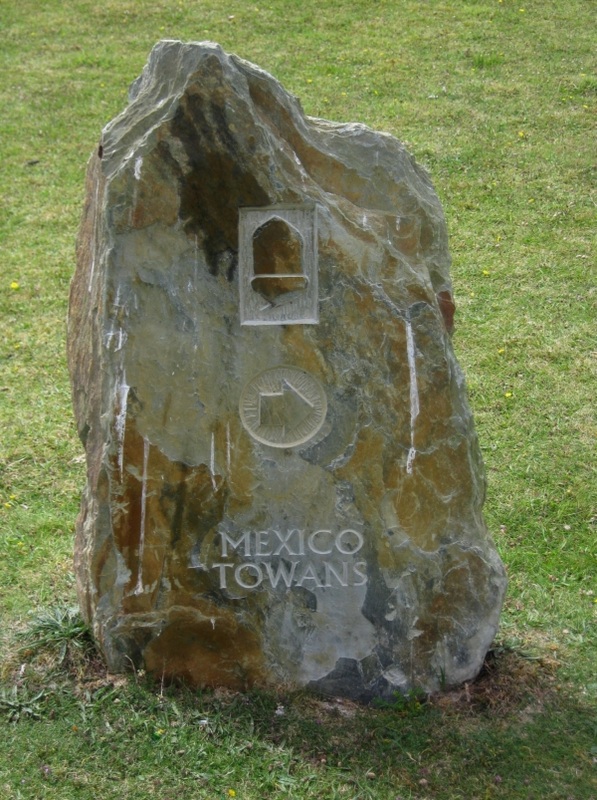
Mexico Towans is next to Hayle Towans. 13.08.2010.
|
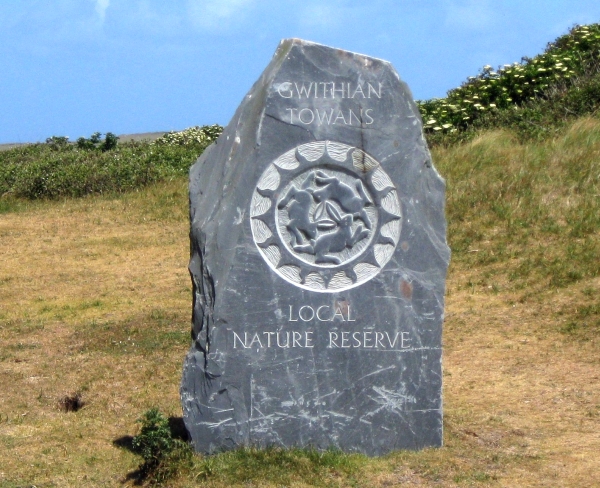
Gwithian Towans is further north, near Godrevy. 07.06.2011.
|
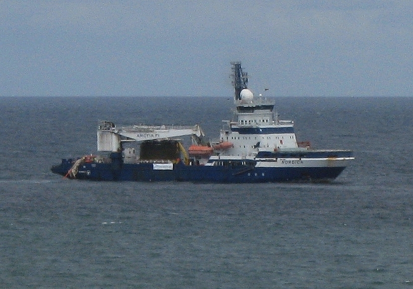
Wave Hub is a wave power research project. The sea-bed hub itself is about 10 miles north of Hayle. These pictures (13.08.2010.) show the cablelayer Nordica bringing the connecting power cable ashore at Hayle Towans beach.
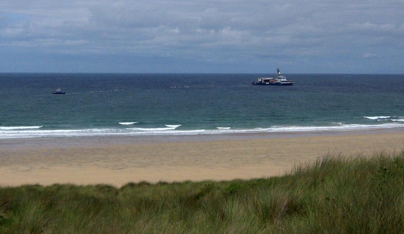
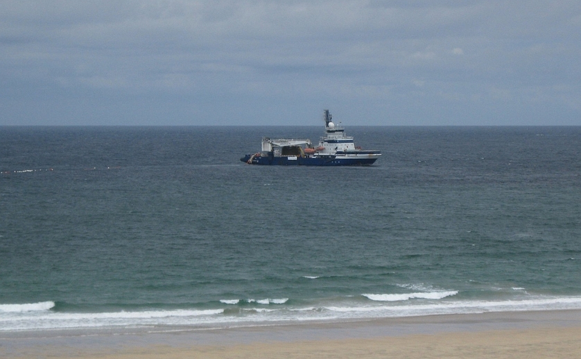
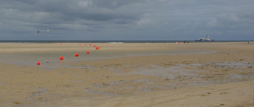
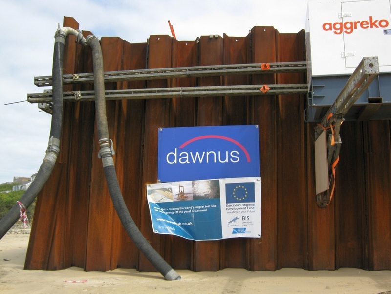
The shore terminal for the power cables.
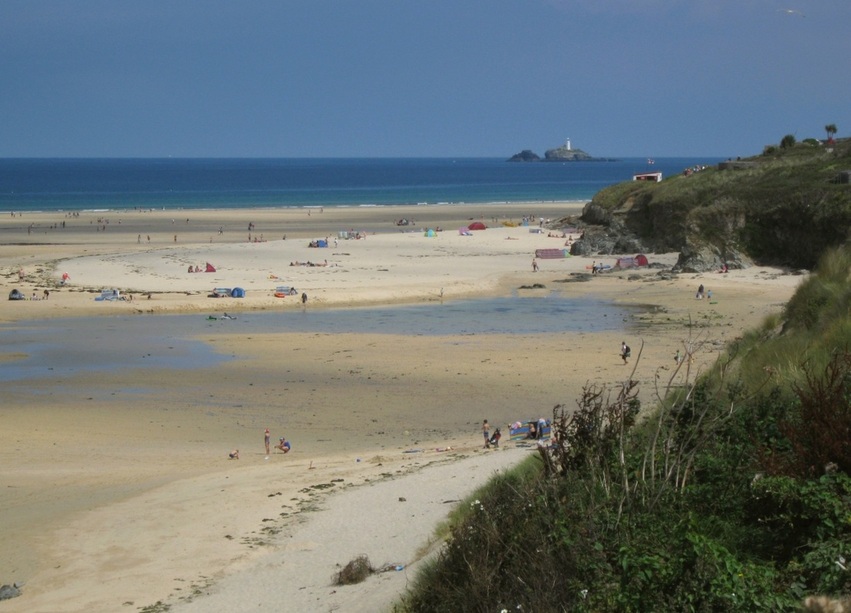
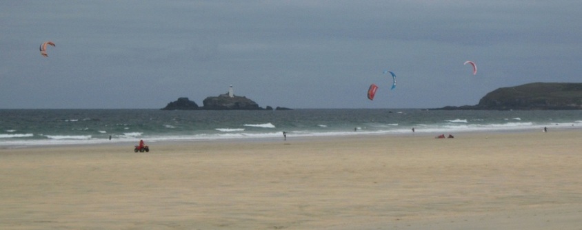
Godrevy Island and Point, with kite surfers 13.08.2010.
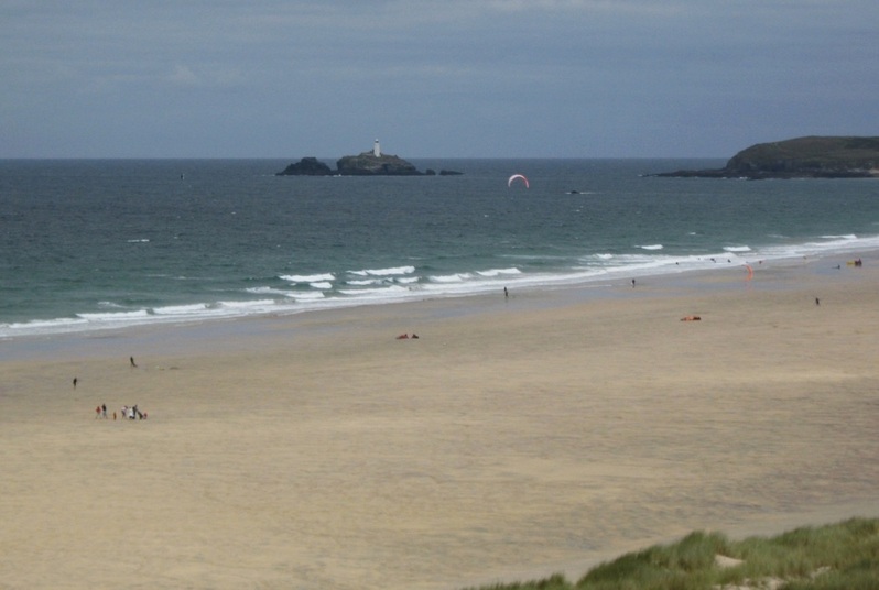
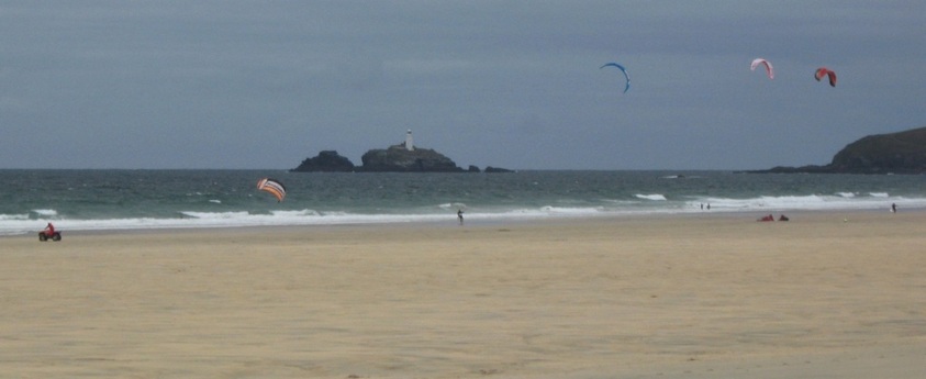
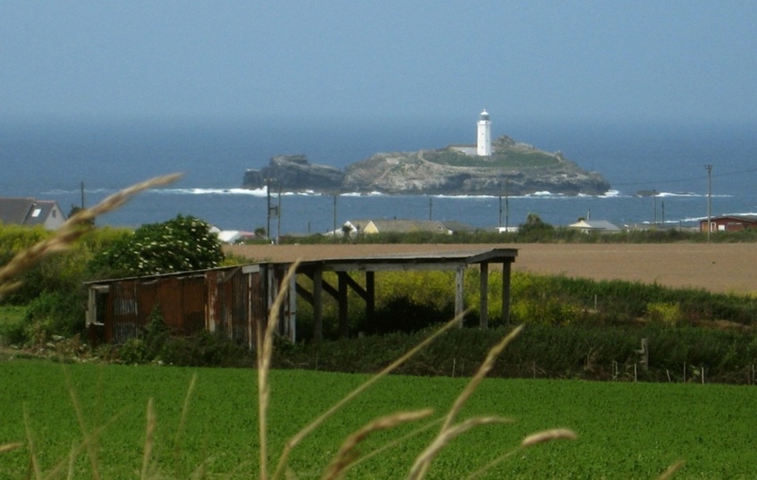
The Lighthouse on Godrevy Island, seen from above Gwithian Towans. 28.06.2008.
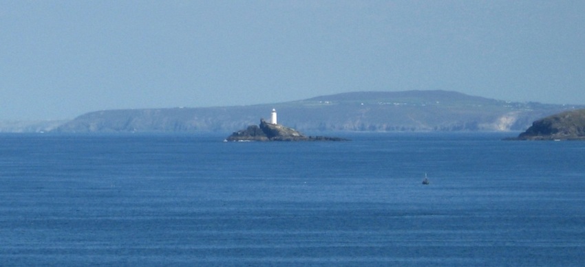
That LH is a camera magnet for miles around! This is the view from St Ives, with St Agnes Head and Beacon beyond. 15.09.2007.
Here the sea is very calm, but Godrevy Island is surrounded by sunken rocks, so in rough weather,
with the tidal stream kicking up overfalls, there would be breaking waves everywhere.
This is the sort of view Virginia Woolf would have when in St Ives on holiday in her childhood, but she also visited
the Lighthouse itself, and it's supposed to be the inspiration for her novel, To the Lighthouse.
with the tidal stream kicking up overfalls, there would be breaking waves everywhere.
This is the sort of view Virginia Woolf would have when in St Ives on holiday in her childhood, but she also visited
the Lighthouse itself, and it's supposed to be the inspiration for her novel, To the Lighthouse.
Gwithian Towans, 07.06.2011.
View of St Ives from Gwithian Towans. (Porthminster beach is on the left.) 07.06.2011.
Gwithian Towans and Godrevy Island.
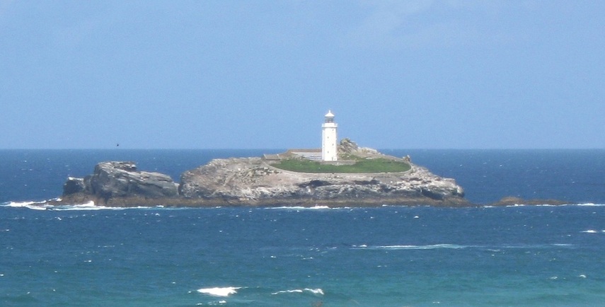
Detail of the island and Lighthouse from the previous photo.
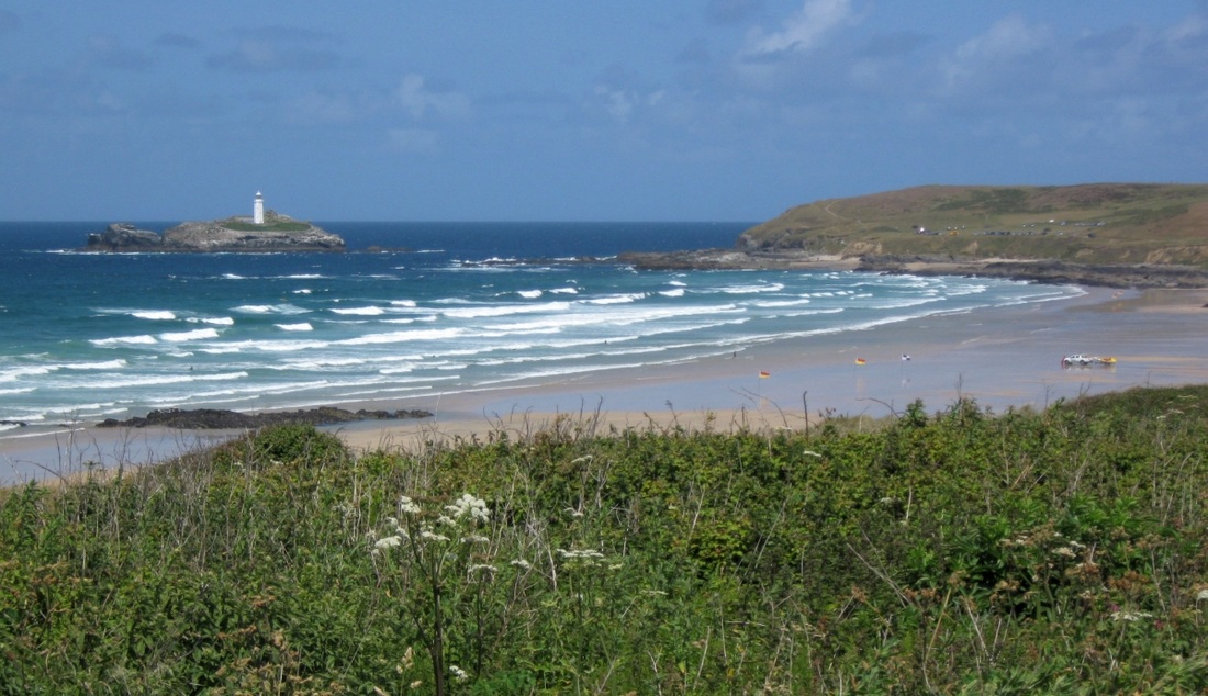
Godrevy Island and Point, and the beaches south of the point, at low tide. RNLI Lifeguards are on patrol here.
Photos of Godrevy can be deceptive, making it appear to be just off the coast at Gwithian.
But it's further away than it seems - it is in fact north of Godrevy Point.
The Red River enters the sea on the far side of the wide sandy beach, although it doesn't show at this angle.
It got its name because it drains the mining districts around Camborne and Redruth, and in the heyday of Cornish mining
it was discoloured by waste and run-off from the mines. Sometimes a plume of red water could be seen in the bay here.
But the story may not end there. A new company, Marine Minerals Limited (MML), reckon there could be enough alluvial tin
in the sands of the bay to be worth exploiting commercially, and trial sampling took place early in 2013. MML have a website here.
