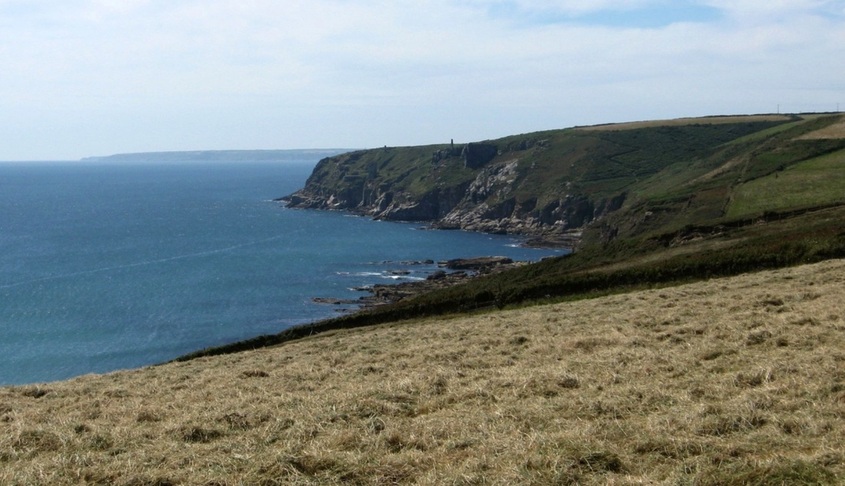
Manacle Point to Penlee Point (2)
From Pedngwinian to the fishing harbour of Porthleven is just over 3 miles, and much of this coast is fronted by sand and shingle, not rock.
About half-way along, this forms Loe Bar, closing off the mouth of a one-time arm of the sea, and creating Loe Pool, a freshwater lake.
About half-way along, this forms Loe Bar, closing off the mouth of a one-time arm of the sea, and creating Loe Pool, a freshwater lake.
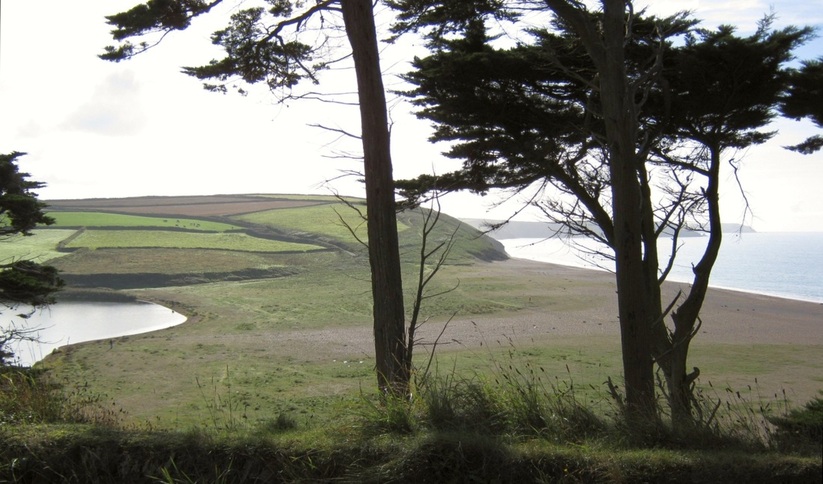
Loe Bar, looking SE towards part of Predannack Head. 13.10.2009.
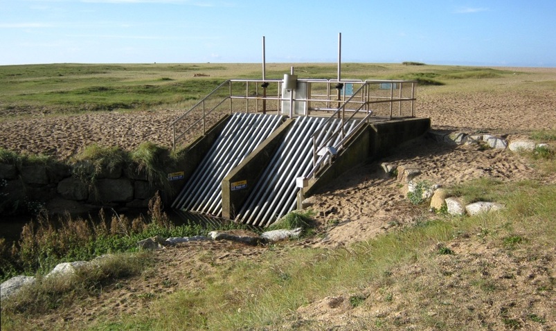
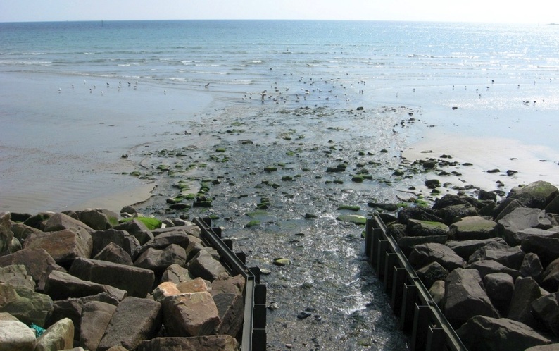
This is where water from the Pool enters the culvert under Loe Bar to drain away to the sea. 13.10.2009.
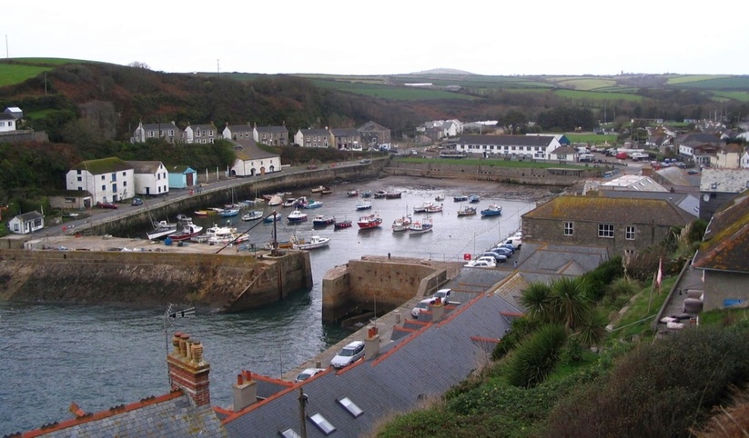
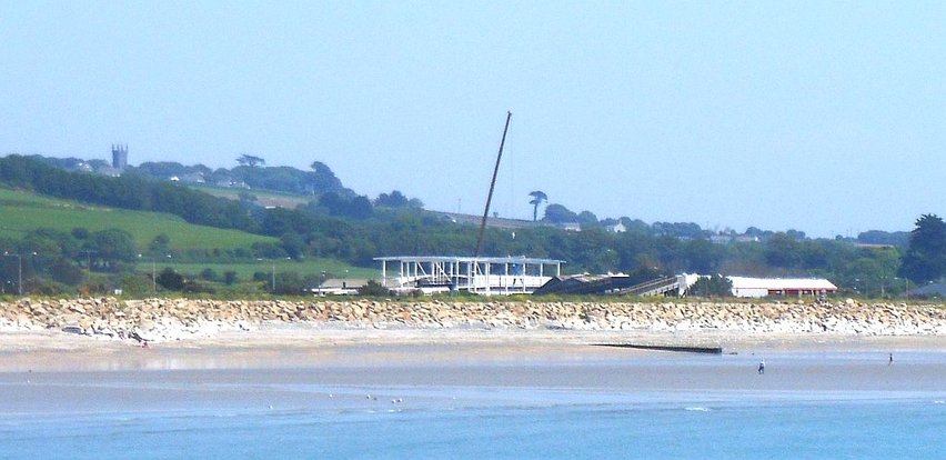
Porthleven
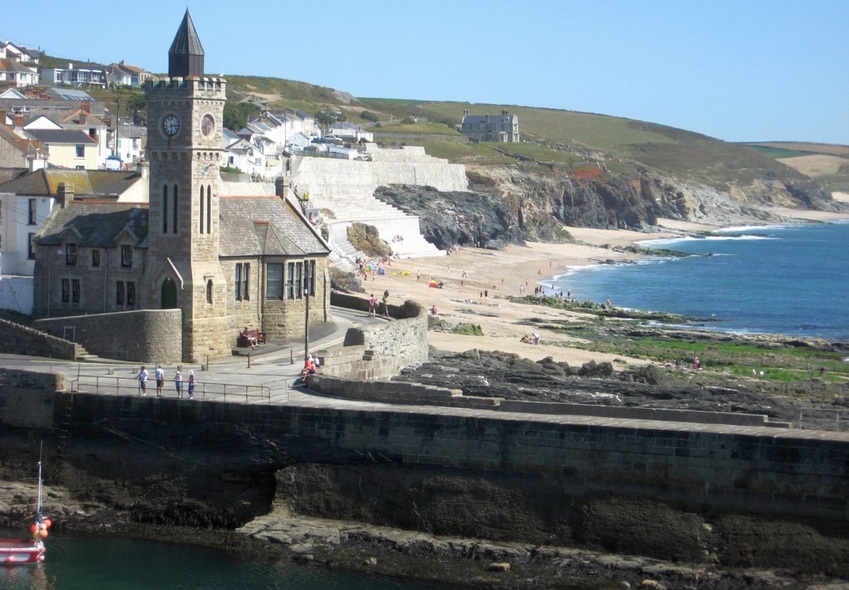
Porthleven Institute (now Council offices) overlooks the harbour entrance and Porthleven beach, which stretches away SE to Gunwalloe. 13.07.2008.
11.11.2006. The pier and the outer harbour. As the inner harbour dries, vessels sometimes pick up a mooring here to wait for the tide.
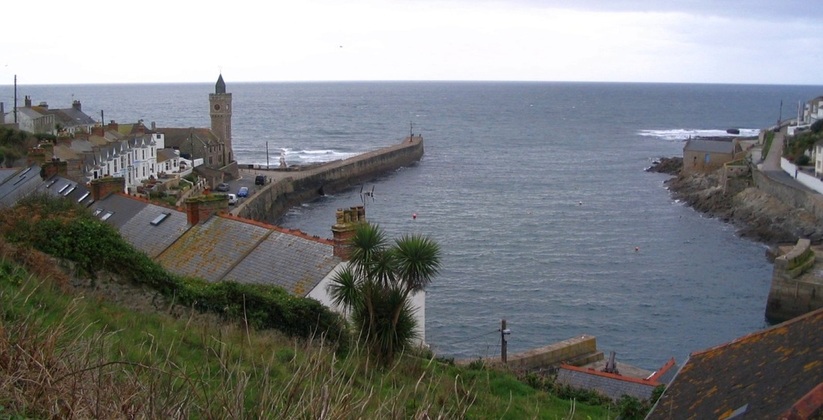
However, Porthleven harbour entrance faces SW, and in stormy weather huge waves often break right over the pier and sea-front.
The inner harbour, near low tide. (In the far distance is Tregonning Hill near Ashton; it can be widely seen from land and sea.)
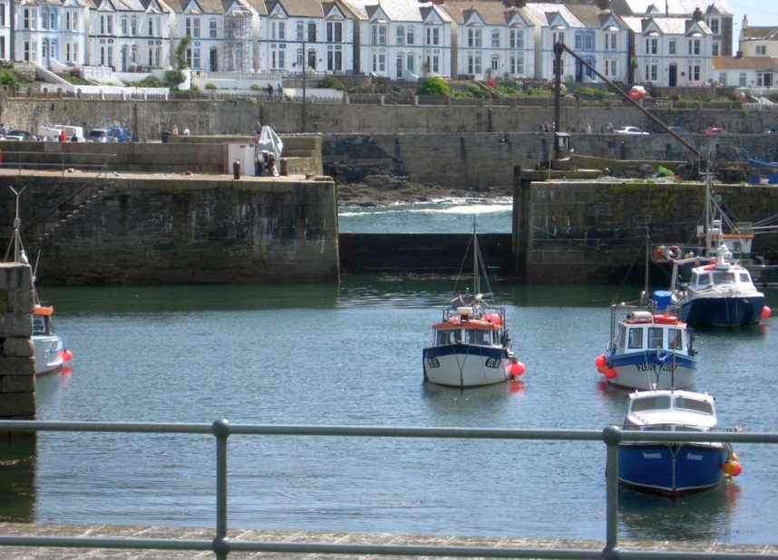
In rough weather, or when there's a heavy swell running, the inner harbour can be closed off with heavy baulks of timber. 30.07.2009.
However, in the storm of Wednesday 5-02-2014, the barrier was smashed and carried away by heavy seas, which then poured into the inner harbour and sank or smashed all the boats there.
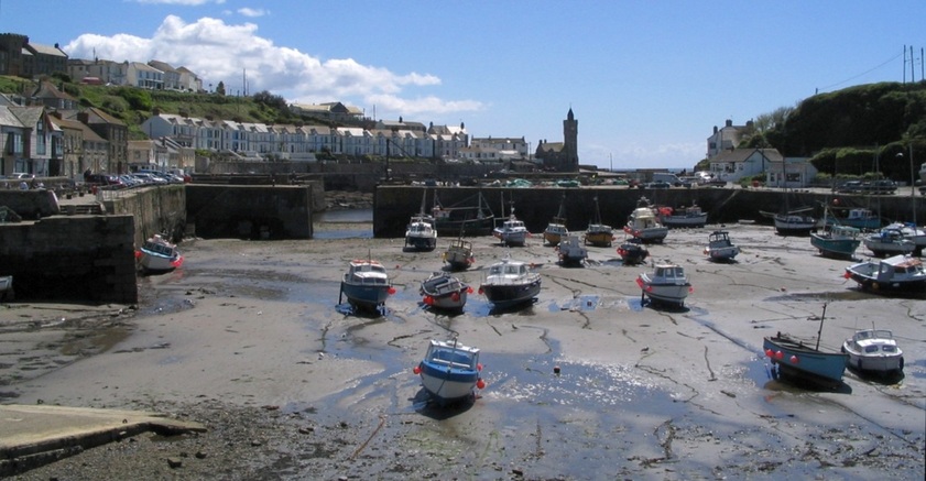
Porthleven inner harbour, at low tide. But the weather's fine, so no need to worry about swell when the tide rises. 09.05.2005.
The Ship Inn (centre) overlooks the outer harbour. 11.11.2006.
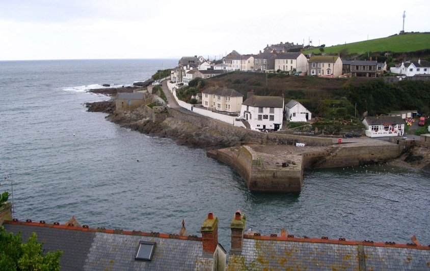
The road on the left of the picture above leaves Porthleven and heads NW through the countryside, towards Ashton.
But first it follows close to the coast, and offers this view of Trewavas Head.
But first it follows close to the coast, and offers this view of Trewavas Head.
23.07.2008: Trewavas Head hides most of Mounts Bay, so the coast seen in the distance is S and W of Mousehole.
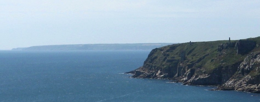
Detail: two chimneys and other structures on Trewavas are the remains of a copper mine.
More information on Wheal Trewavas Mine. The distant coast includes Porthcurnow, with its Telegraph Museum, and the Minack open air theatre.
It also includes Cornwall's most recently built lighthouse, Tater du lighthouse, and Lamorna Cove.
Beyond Trewavas Head lie Praa Sands and Kennegy Sands, both sandy beaches, but we'll skip them and head for Prussia Cove. 24.06.2009.
It also includes Cornwall's most recently built lighthouse, Tater du lighthouse, and Lamorna Cove.
Beyond Trewavas Head lie Praa Sands and Kennegy Sands, both sandy beaches, but we'll skip them and head for Prussia Cove. 24.06.2009.
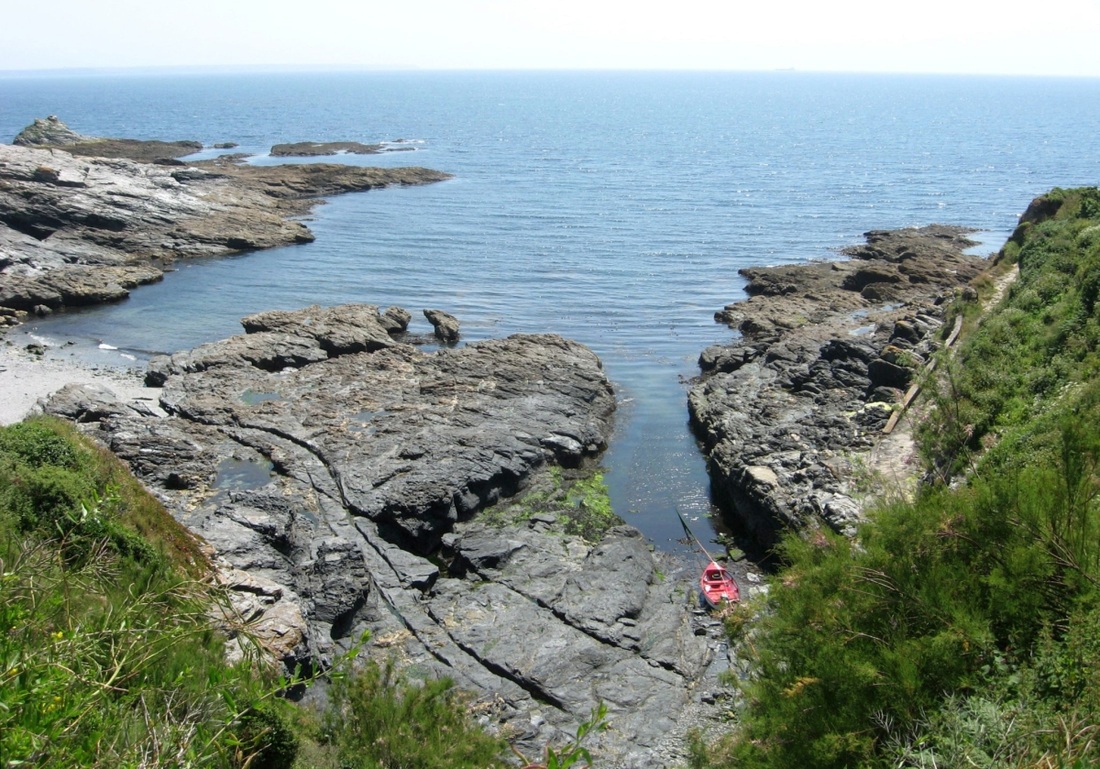
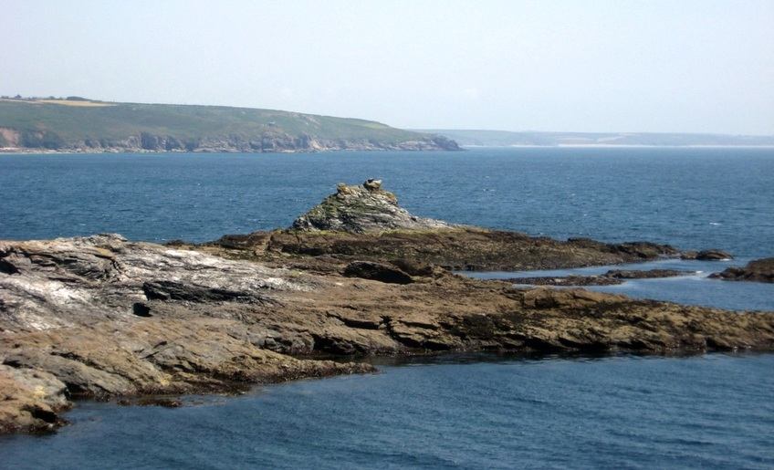
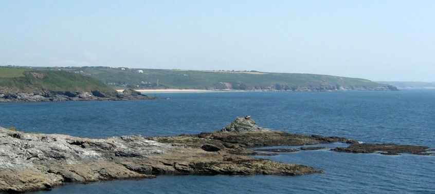
Smuggling territory - a rocky shore, with the Lizard to the SE.
|
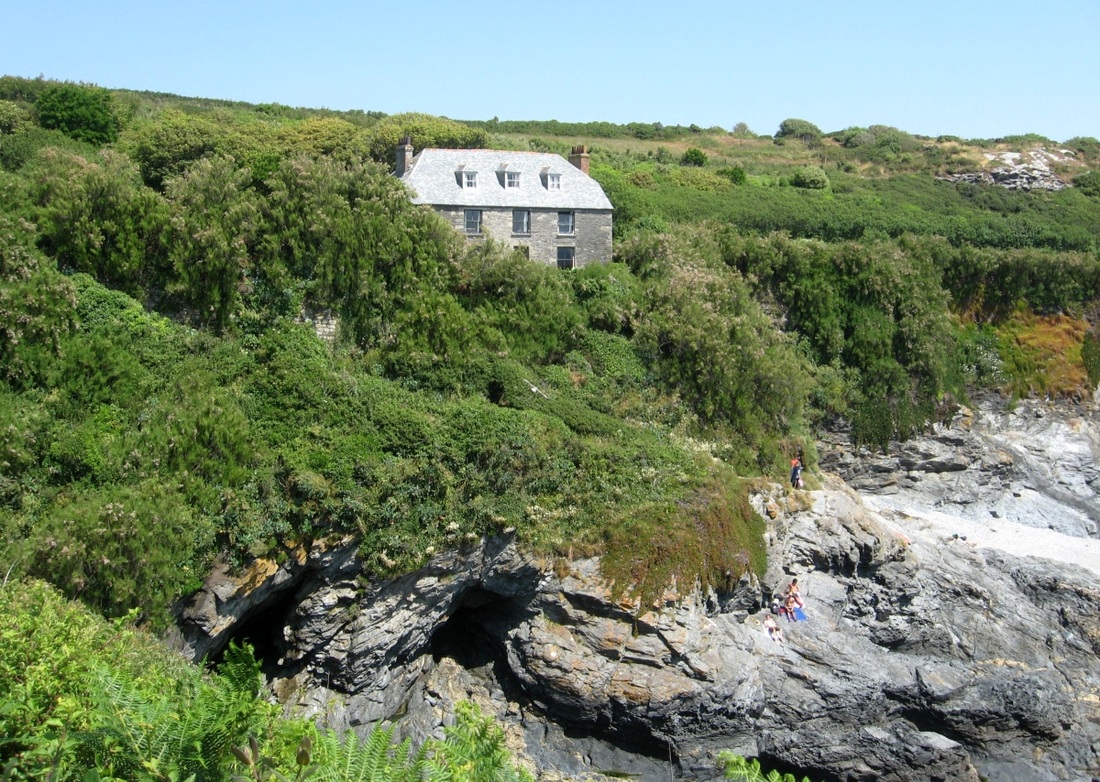
A cottage and caves.
|
Prussia Cove is where a famous RN warship of WWI and WWII, HMS Warspite, finally met her end.
View ESE from Bessy's Cove. The Enys is a distinctive rock, and beyond that are Rinsey and Trewavas Heads. In the distance is Porthleven beach.
A wider view and another angle shows part of Praa Sands. (Kennegy Sands are out of view to the left, this side of the nearest headland, Hoe Point.)
Above: Piskies Cove and Little Cudden - Right: The piskie?
|
|
"Sometimes I sits and thinks, and sometimes I just sits..."
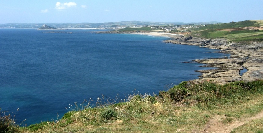
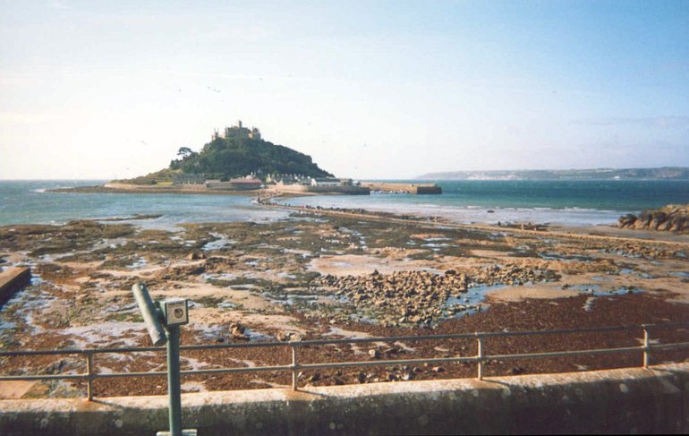
View from Cudden Pt. to Penzance. Perran Sands are in the middle distance, and St Michaels Mount lies off Marazion.
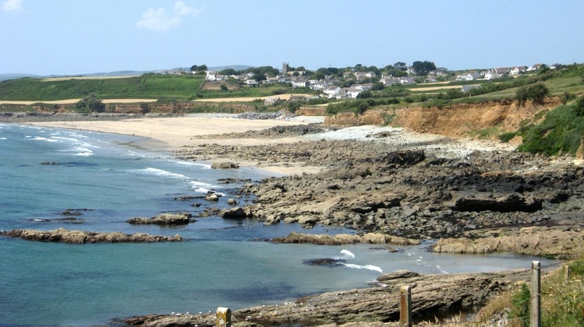
A closer view of Perran Sands, with the village of Perranuthnoe behind. The low spring tide shows the hazards unwary seafarers face.
Another view of the rocky hazards off Perran Sands.The reef to the left is The Greeb, and the rocky headland just beyond the sands is Maen-du Pt..
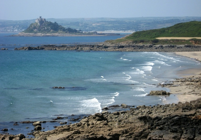
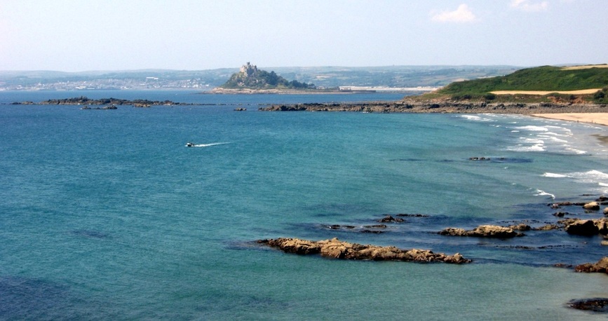
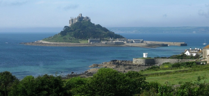
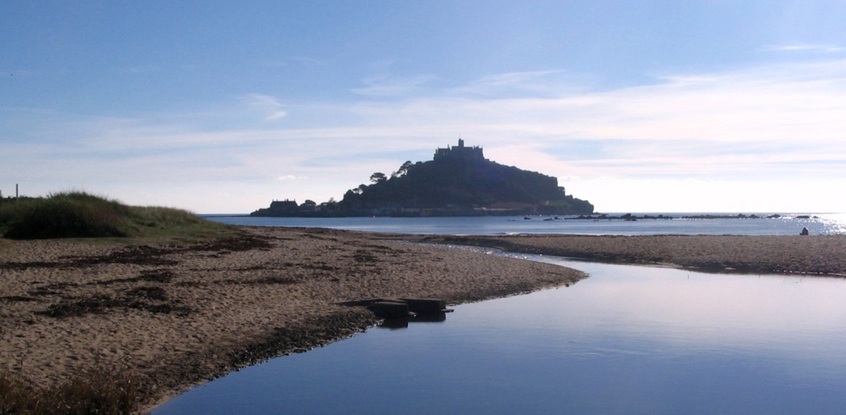
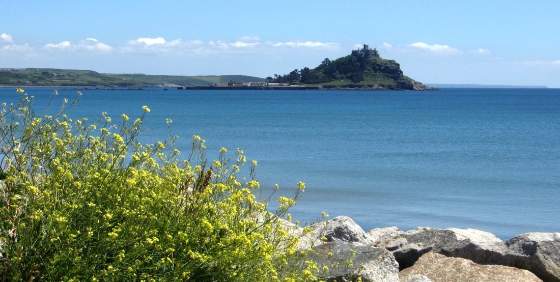
St Michaels Mount - this prominent tidal island defines the whole area as Mounts Bay, from say Mullion in the east to Lamorna in the west.
(End of 24.06.2009. photo sequence.)
St Michaels Mount must be one of the most photographed places in Cornwall! From here on, I will use the abbreviation St MM for it.
St Michaels Mount must be one of the most photographed places in Cornwall! From here on, I will use the abbreviation St MM for it.
St MM is a tidal island. Now, at low tide, it can be accessed by a causeway, but at high tide launches carry visitors to and from the harbour (right).
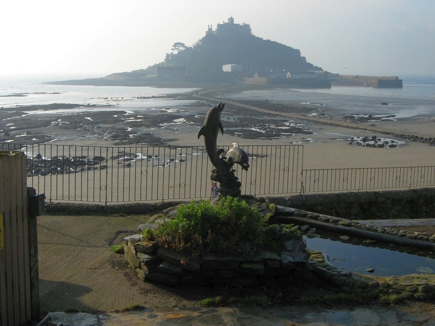
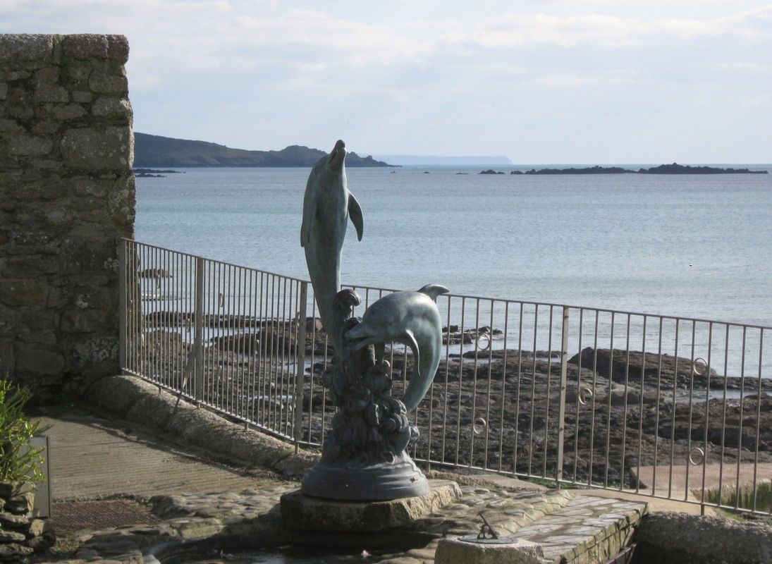
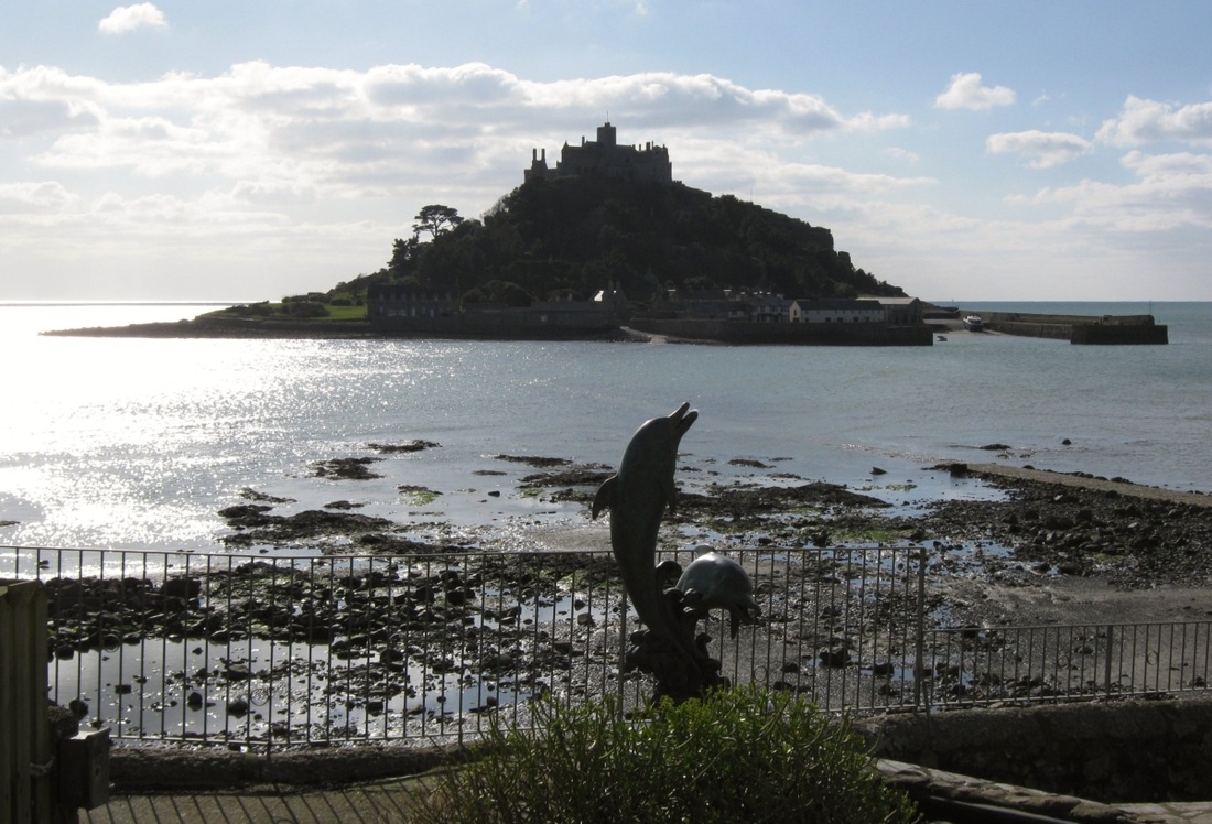
Sadly, the bronze dolphin sculpture seen above, in the garden of the Godolphin Arms Hotel, Marazion, photographed 09.02.2008,
was stolen by metal thieves in May that year. It was replaced in 2010 by a bronze-coloured plastic or fibreglass version.
Happily, these pictures of the replacement, 11.02.2010, amplify the tidal theme.
was stolen by metal thieves in May that year. It was replaced in 2010 by a bronze-coloured plastic or fibreglass version.
Happily, these pictures of the replacement, 11.02.2010, amplify the tidal theme.
The Greeb, Cudden Pt, and the Lizard to the SE at LW...
|
..but the tide is already over the causeway to St MM.
|
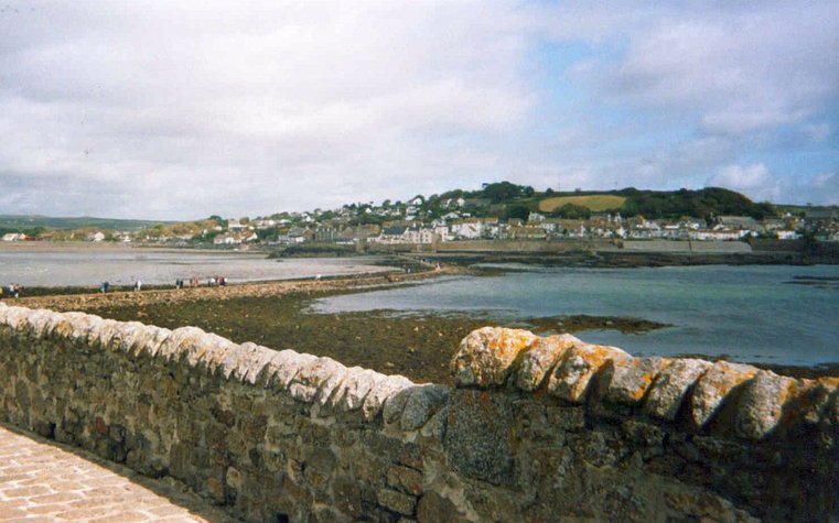
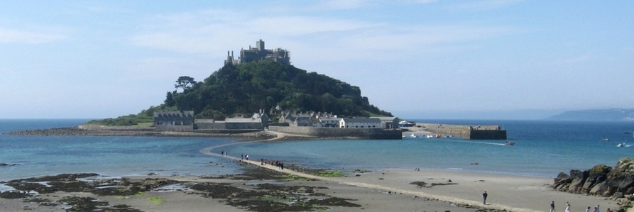
St MM at low tide, showing the causeway and harbour. Just to the right, in the distance, is the village of Mousehole. 2004.
Marazion seen from St MM. 2004.
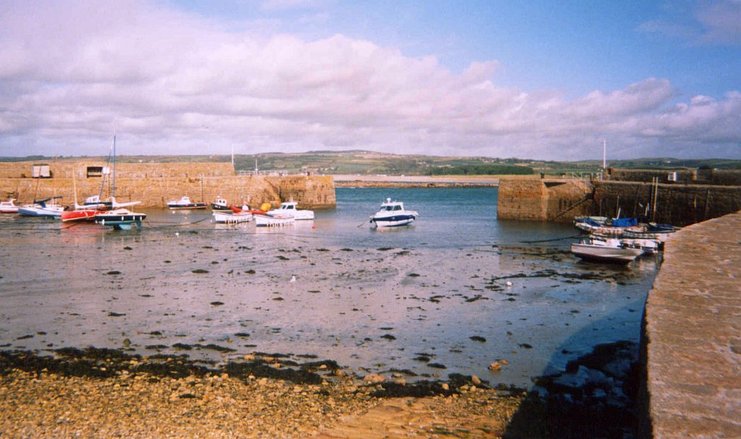
Low tide in the harbour at St MM. The harbour entrance faces north, towards the mainland. 2004.
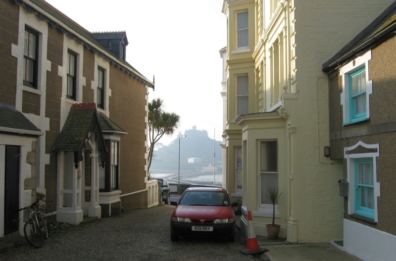
09.02.2008. From Marazion, it's hard to resist snapping away at St MM - my oldest photo is B&W, from 1968!
31.05.2008. The causeway is covered, but there are some people on the landward end. Beyond St MM is part of Mousehole.
10 minutes later: the last people to paddle back before the tide got too high are leaving the causeway. The ferry is already running from the harbour.
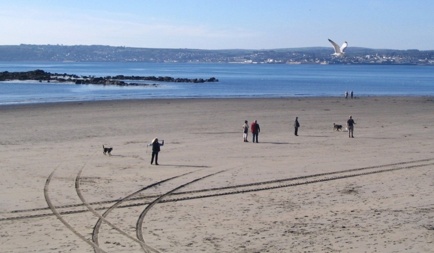
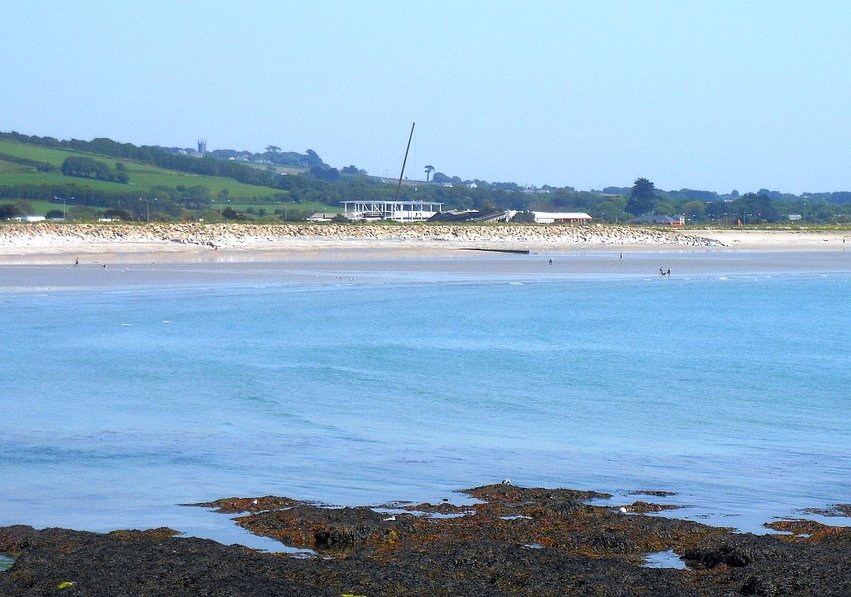
04.11.2006. Low tide: a sandy beach links Marazion to Penzance, with many rocks running off into the sea. Newlyn and Penzance are in the background.
The port registration numbers for fishing boats registered in Penzance begin with PZ,
and this is often used locally as an abbreviation for the town.
From here on, I'll use PZ this way.
and this is often used locally as an abbreviation for the town.
From here on, I'll use PZ this way.
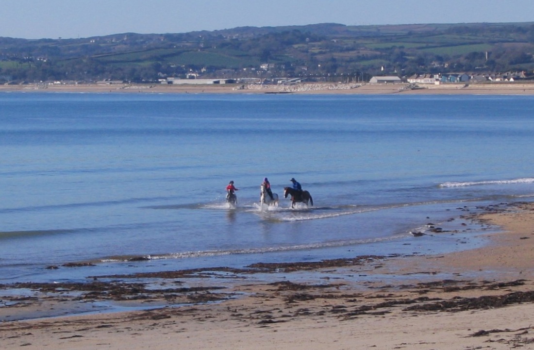
Wintertime, with no swimmers or sunbathers around...
|
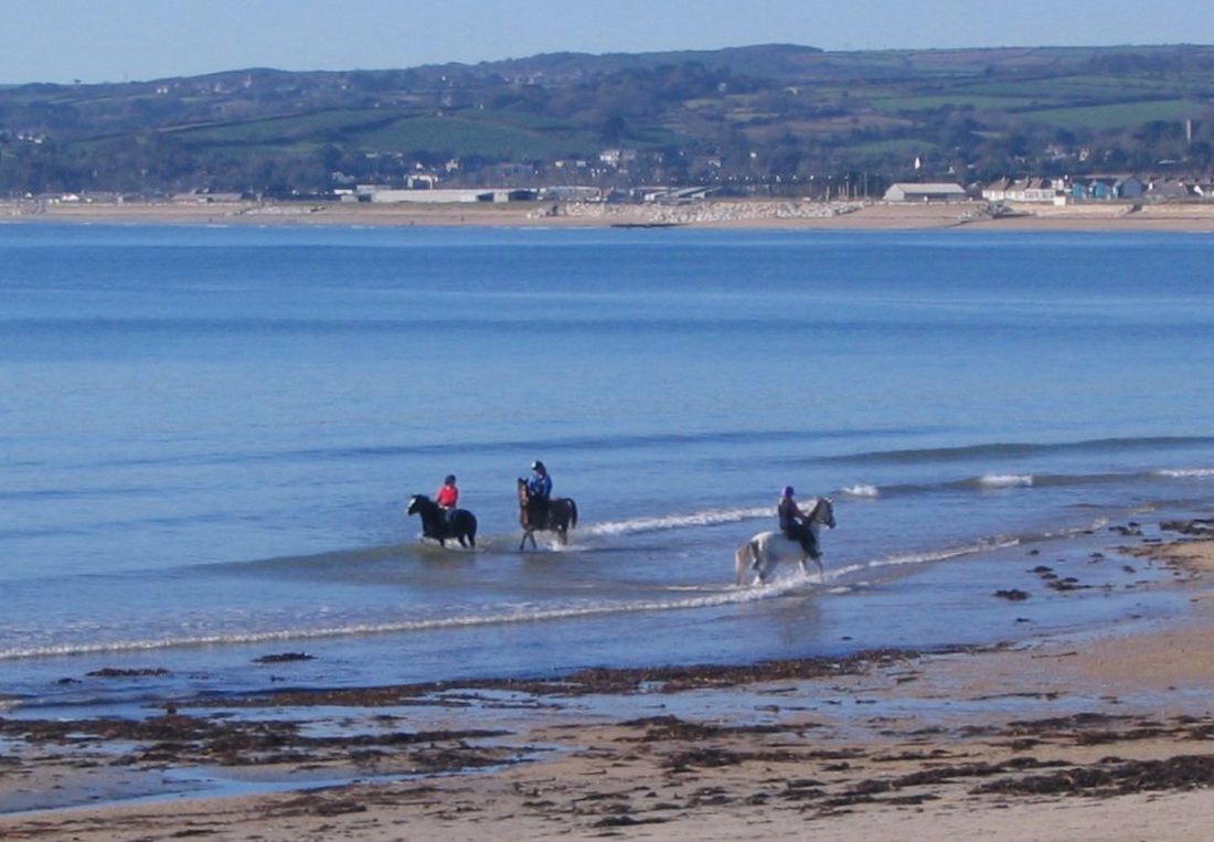
..is a good time to exercise horses on the beach.
|
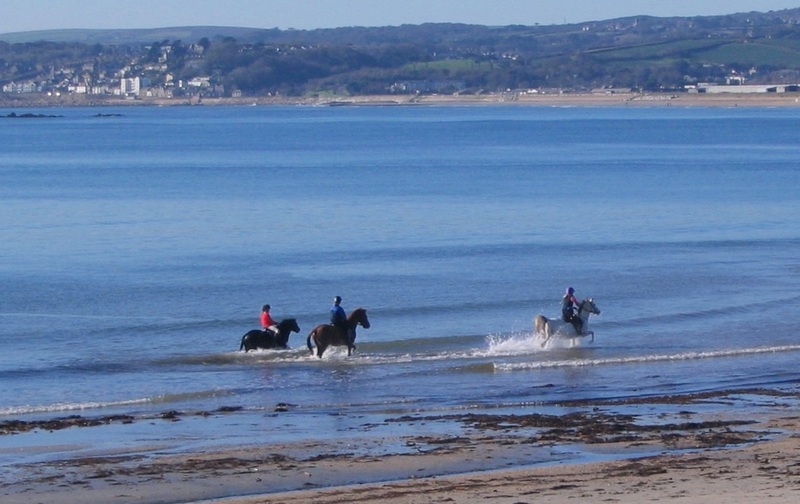
"Hi ho, Silver, away!"
This stream flows into the Bay from Marazion Marsh. Its path across the beach varies according to the longshore drift, as caused by recent winds.
Marazion Marsh contains Cornwall’s largest reed bed, and is managed as a nature reserve by the RSPB.
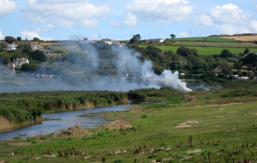
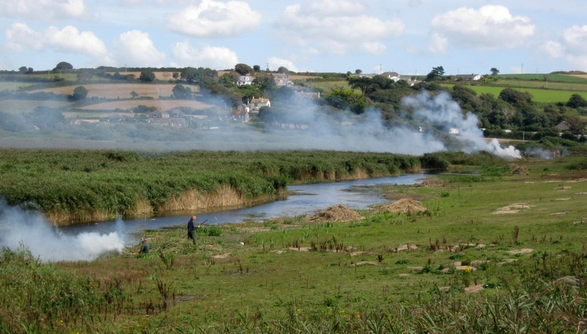
Marazion Marsh, the end of August - the waterways have been cleared, and surplus growth cut back and burnt.
Once, this was probably a salt-marsh on the north side of Mounts bay, but the building of the sea wall and road have cut it off from the sea.
|
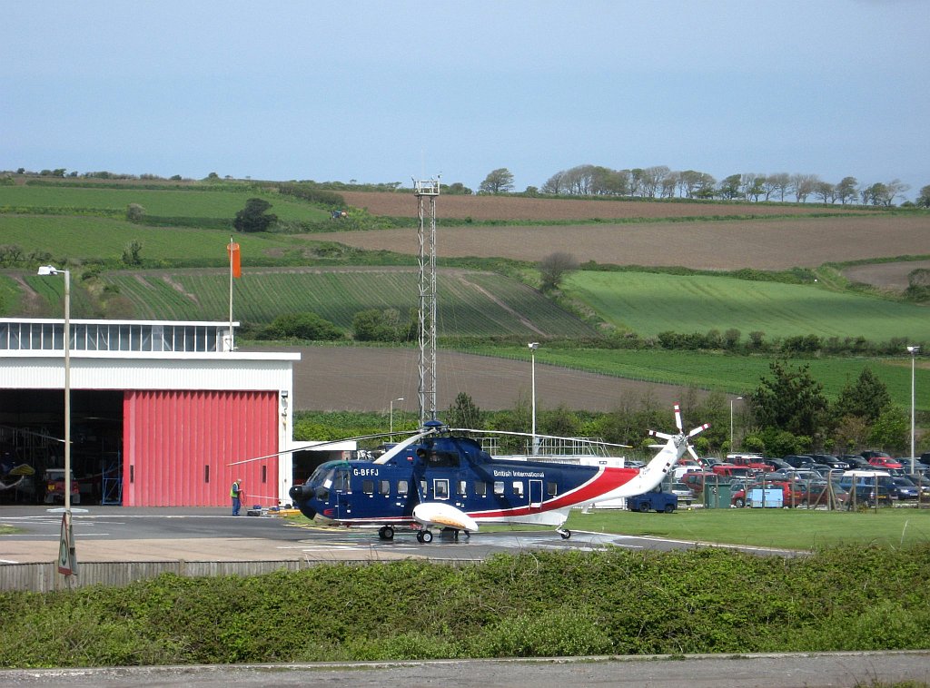
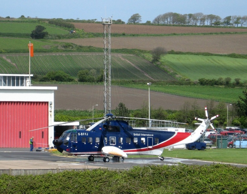
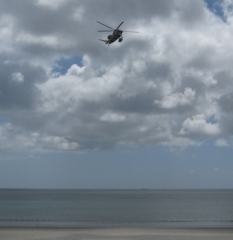
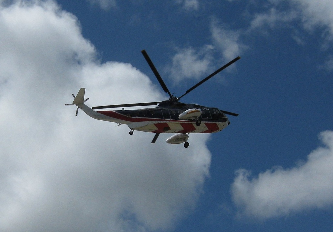
For many years, walking the Promenade from Marazion towards the eastern outskirts of PZ would provide a view, just over the adjacent main line railway and the road, of Penzance Heliport, which operated regular helicopter flights to the Isles of Scilly. The Heliport opened in May 1964, and operated until 31 Oct 2012, when the site was sold off for a new Supermarket... Both pictures (different crops of the same photo, 02.05.2009) show the helicopter just after it has been washed down. They flew in usually salt-laden air, following the coast south and west before crossing the open sea to Scilly. .
|
|
These photos were taken 01.04.09.
|
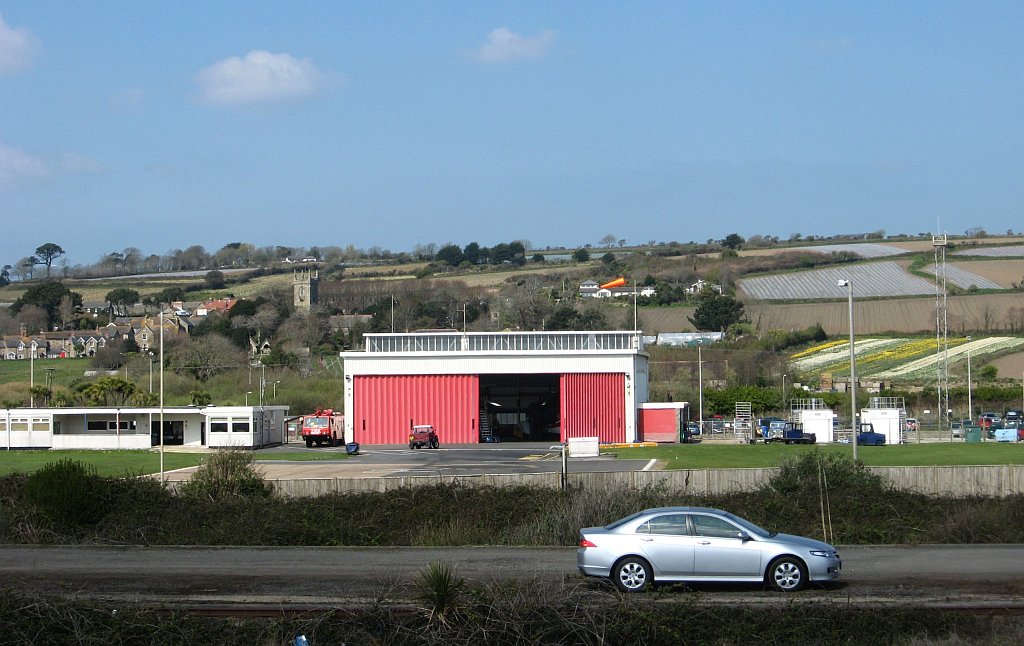
The church in the background is at Gulval.
|
|
Rotary wings over the sea. 31.05.2011.
|
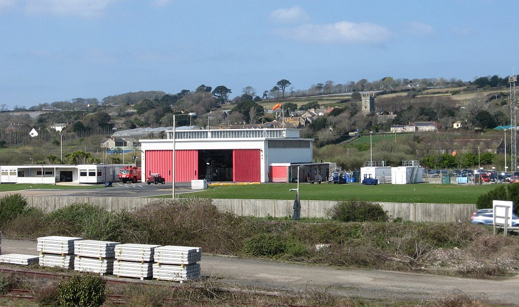
But History took away the whirly birds, and soon the construction machinery moved in to the old heliport, building a new Sainsburys...
Part of the Prom, with the building work behind. Also seen is the footbridge that crosses the railway line. The church on the skyline is at Ludgvan.
|

<< 09.07.2013. ^^
|
The supermarket is now open and doing business. Recent news:
Newlyn Fishermen's Mission chosen by new Sainsbury's store staff to be charity of the year
Monday, November 25, 2013
The Cornishman Full Story:
Newlyn Fishermen's Mission chosen by new Sainsbury's store staff to be charity of the year
Monday, November 25, 2013
The Cornishman Full Story:
01.04.2009. This stream had to flow under the main road and railway line into PZ before reaching the sea.
11.06.2008. A view from near PZ. Behind St MM, the Lizard coastline dwindles away to the SE.
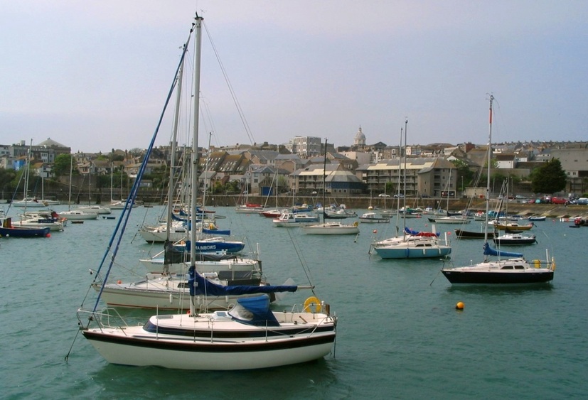
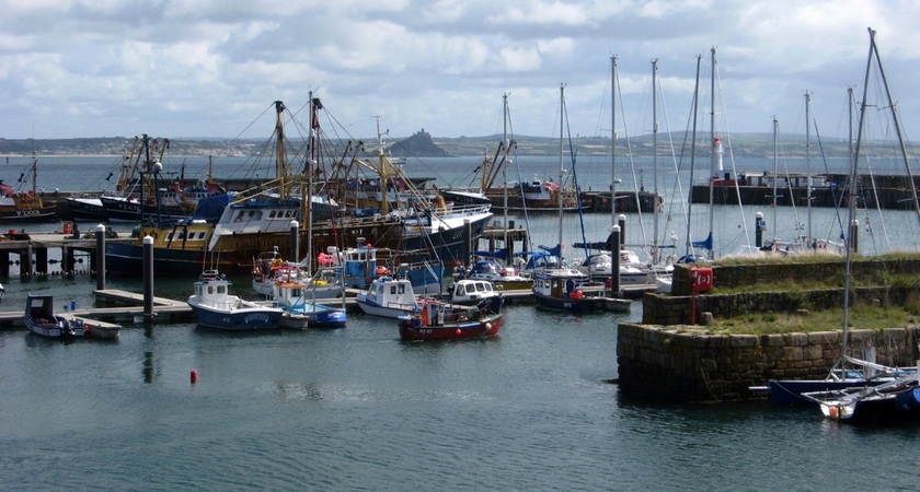
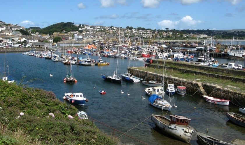
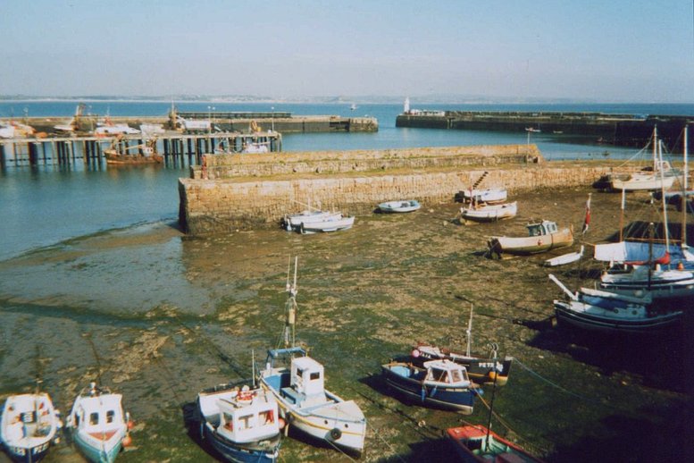
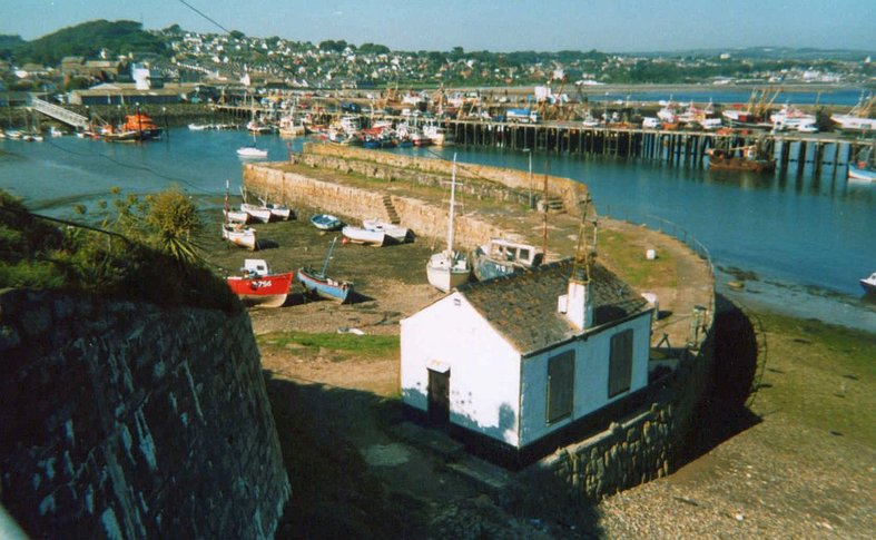
28.04.2007. PZ inner harbour, near high tide. This area dries out entirely at low water.
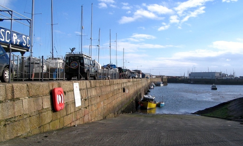
01.03.2006. The main slipway for the inner harbour. The wall to the left is good to dry out on for a scrub. The way to the sea is ahead and turn left.
01.03.2006. PZ outer harbour has gates to keep the water in, allowing vessels to remain afloat at all times.
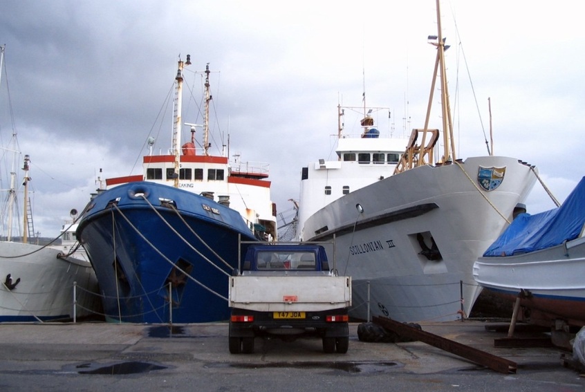
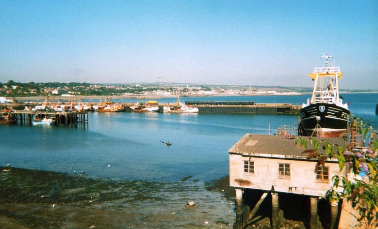
RMV Scillonian III is the ferry for the isles of Scilly. It works seven or eight months of the year, doing a round trip per day.
26.05.2007. PZ harbour entrance, seen from the west side of the inner harbour. St MM is seen behind the harbour light.
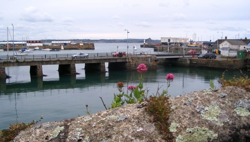
Wharf Road crosses the western part of the harbour via a bridge to access the floating harbour and link up with Western Promenade.
But there is a small dry dock just SW of the road (its entrance is at the far right of the photo above),
so part of the bridge is a swing bridge to allow vessels access to the dry dock at high tide.
But there is a small dry dock just SW of the road (its entrance is at the far right of the photo above),
so part of the bridge is a swing bridge to allow vessels access to the dry dock at high tide.
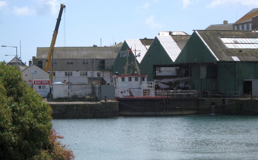
The dry dock gates, and a vessel in the drydock. 08.08.2011.
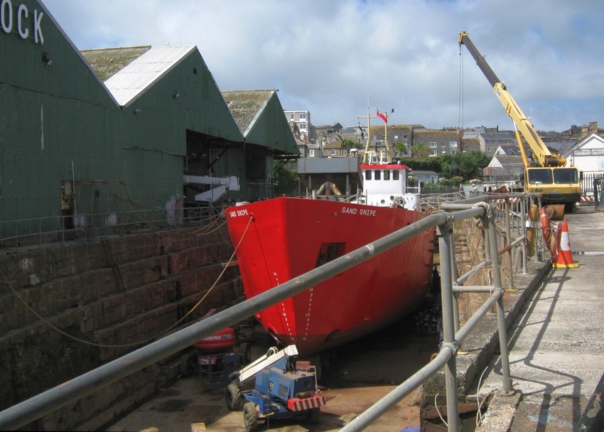
Small suction dredger Sand Snipe undergoing refit in PZ dry dock. 08.08.2011.
There's a picture gallery showing how Sand Snipe was warped into the dock. (Not mine! But there's a date discrepancy I'm checking on...)
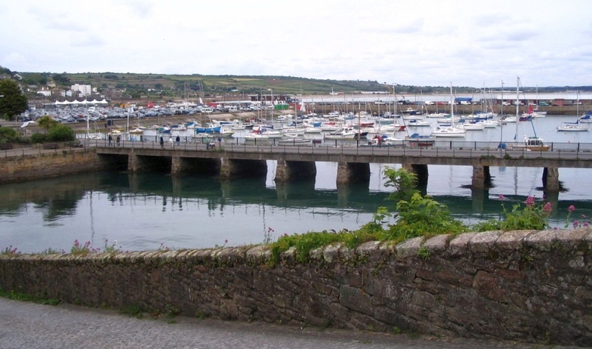
The north part of Wharf Road bridge, and the shallowest part of the inner harbour, where only small craft berth.
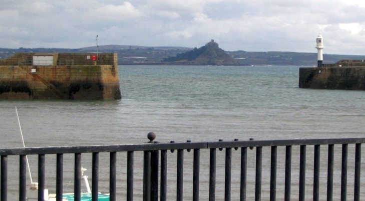
St MM is framed by the PZ harbour entrance.
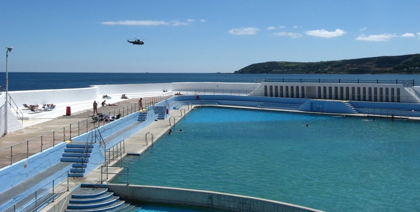
11.06.2008. Just west of the harbour is the Jubilee bathing pool. To the south is Penlee Point, with part of St Clement's island off Mousehole beyond it.
The helicopter seen in the picture above is one of a BIH fleet that ran a regular shuttle service from PZ heliport to the Isles of Scilly.
(Photos and info on the heliport halfway up this page.) Sadly, the service stopped in October 2012, after more than 48 years
of operation; the airfield is now the site of a new supermarket.
There are good beaches east of PZ, but the beaches to the west are largely stoney and rock-strewn.
The tide can rise up the sea-wall at high water, which is not ideal for safe bathing, so a pool was needed.
The Jubilee Pool was completed in 1935, and named for King George V's silver Jubilee.
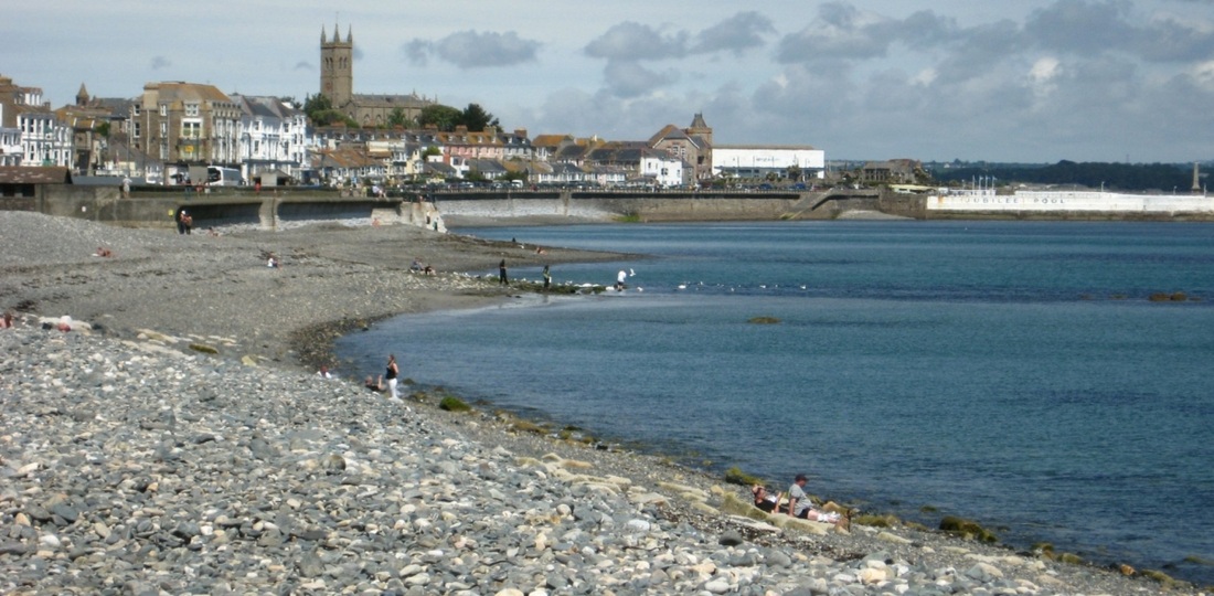
The Jubilee Pool, and the stoney beaches to its west. Dominating the skyline above the town is the church of St Mary's.
Just inside the harbour light is the Newlyn Tidal Observatory. This was used to determine the
Mean Sea Level that was used as the benchmark for all heights given on Ordnance Survey Maps.
Mean Sea Level that was used as the benchmark for all heights given on Ordnance Survey Maps.
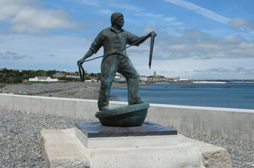
11.06.2008. Promenaders arriving at Newlyn encounter this statue of a young fisherman. Newlyn is one of the busiest fishing ports in the UK,
as will be seen below.The statue is known locally as Tom. (PZ and the Jubilee Pool are seen in the backgound of the photo.).
as will be seen below.The statue is known locally as Tom. (PZ and the Jubilee Pool are seen in the backgound of the photo.).
09.07.2005. A stream meets the sea here, alongside the North Pier. The boulders are to prevent storm surges entering the town.
But in the extreme storms of February 2014, they weren't enough - swells and breakers swamped the town center.
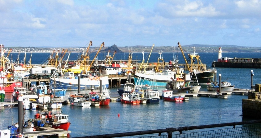
04.03.2008. Mounts Bay and St MM as background to Newlyn Harbour.
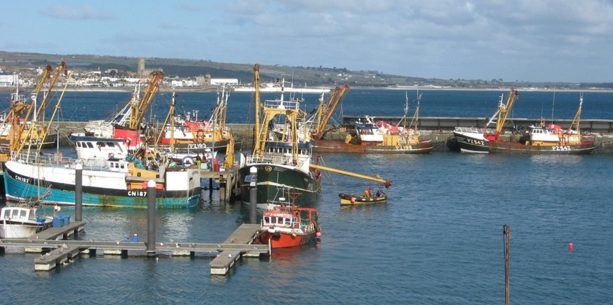
04.03.2008. Most of these fishing vessels are local, and carry PZ registration numbers, but CN refers to Campbeltown in Scotland.
09.07.2005. Fishing vessels lie alongside the inner part of North Pier. The deeper water is towards the entrance.
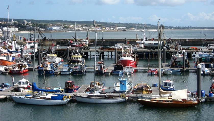
30.07.2009. Smaller craft moor in the inner harbour.
30.07.2009. The inner harbour. The modern Lifeboat station is towards the back of this view.
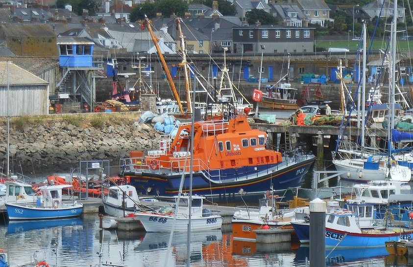
The Severn class Penlee LB on station, 03.08.2013.
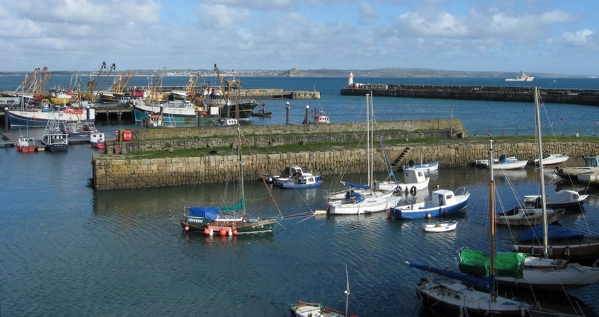
04.03.2008. The inner harbour. Beyond the South Pier the MCA tug is anchored in the bay.
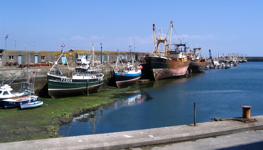
A similar view of the inner harbour quay, but taken at low tide in 2003.
Another angle on the inner harbour quay. Note the old lifeboat mooring, and there were fewer pontoons then. 2003.
In the SW corner of Newlyn harbour is a slipway where vessels can be hauled clear of the tide for repairs and maintenance. 2003.
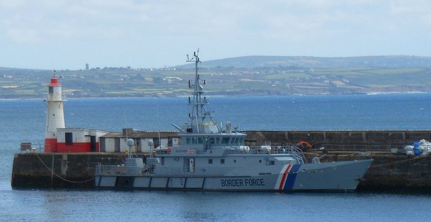
Border Force vessel 'Seacher', in Newlyn. 03.08.2013.
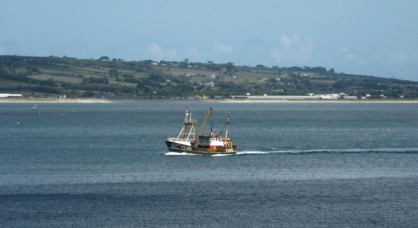
30.07.2009. A Newlyn trawler returning to harbour with her catch. (The church tower behind is at Ludgvan, just over a mile inland.)
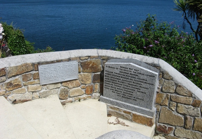
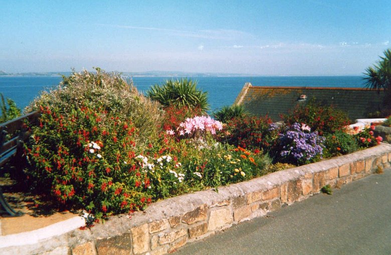
Penlee Lifeboat Disaster memorial is above the old lifeboat house at Penlee Point. 30.07.2009.
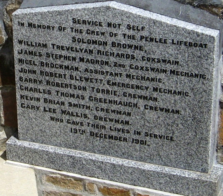
Penlee Lifeboat Disaster The Solomon Browne lifeboat went to the aid of a coaster, the Union Star, in a winter storm on 19. 12. 1981. But sadly both vessels and sixteen people were lost. |
|
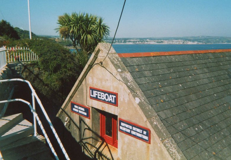
The old Penlee LB House. After the 1981 disaster, the LB station was moved into Newlyn. (Penzance is seen in the distance.) 2003.
Penlee Memorial Garden. 2003.
