Penlee Point to St Ives (2)
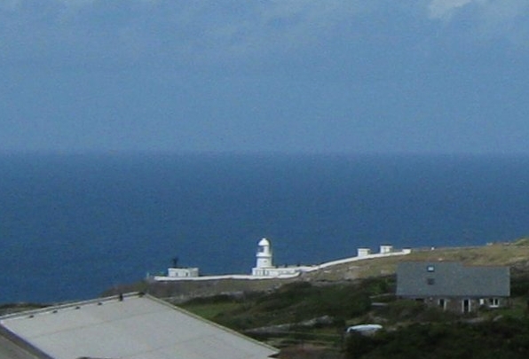
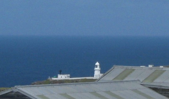
There are no harbours or sandy coves to be found north of Cape Cornwall. The next significant headland is Pendeen, with its lighthouse (LH). These two pictures (16.06.2011.) were taken from the vicinity of Geevor Mine, now a museum and heritage centre, which is about 3 miles to the south of the LH. In the picture of the mine headgear (04.06.2006.), the LH can be glimpsed through the headgear itself!
|
|

Geevor Mine museum. (Click image for details.)
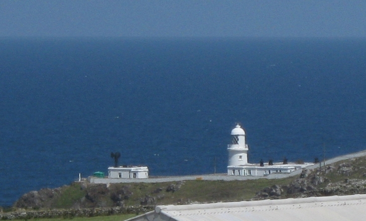
The most detailed shot shows the foghorns (L) as well as the LH (R). 23.06.2011.
Pendeen LH seen from high ground on the main coast road, several miles to the ENE. 23.06.2011.
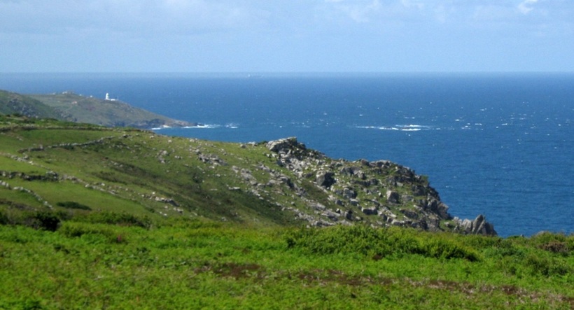
The white water to the right marks The Wra, or Three Stone Oar rocks, that lie just north of Pendeen.
In the hazy distance, a ship is heading north, perhaps to Milford Haven or the irish Sea.
There is a sandy bay just east of Pendeen, the only one for miles in either direction along this rocky coast.
In August 2011, a container ship managed to briefly run aground there, amazingly missing all the rocks around!
"Ship runs aground near Cornwall's Pendeen lighthouse" - BBC News Report
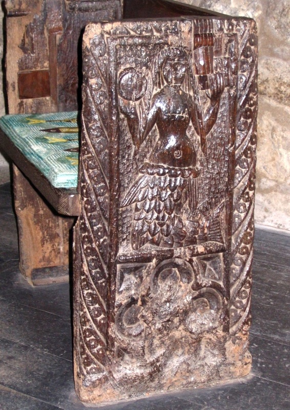
The Zennor Mermaid
Legend says that a mysterious and beautiful lady used to attend Church in the tiny hamlet of Zennor. But one day she and Mathey Trewella, "the best singer in the parish" disappeared, and neither were ever seen again. Some time later, a ship anchored off Pendour Cove, below Zennor, and a mermaid appeared. She asked them to raise their anchor, as it was blocking her door. On hearing this the villagers decided that the mermaid was none other than the mysterious lady who had disappeared, and to commemorate the tale a mermaid was carved into a pew of the church.
For a fuller version of the story, click the image below. (Photos: 26.05.2007.)
For a fuller version of the story, click the image below. (Photos: 26.05.2007.)
|
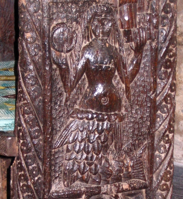
The mermaid holds a glass (mirror) and a comb.
|
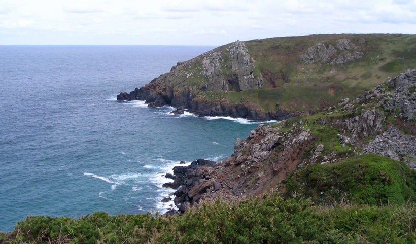
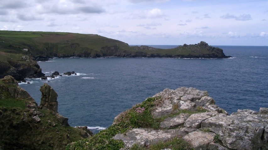
Pendour Cove - the Mermaid's home? - is about half a mile NW of Zennor, and faces NW.
Another angle on Pendour Cove, and, closer, Veor Cove.
This NW part of the coast is very harsh, with no harbours; there are only dangerous headlands separated by stoney coves.
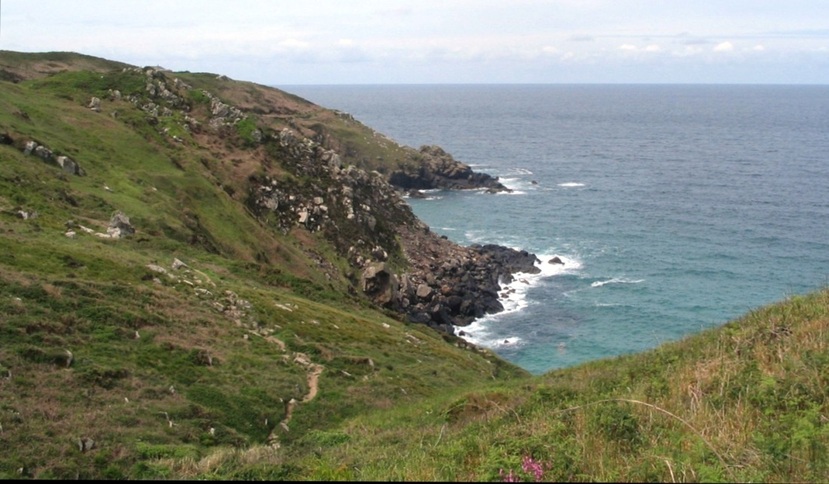
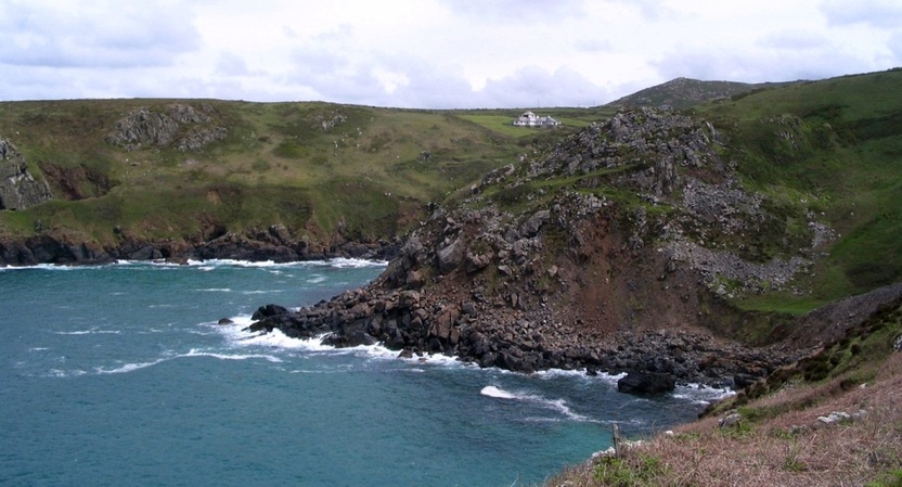
First zoomed view west from above Pendour Cove. Two un-named headlands enclose Veor Cove.
The same two headlands appear in the next view, which shows the coastal footpath that leads west along the cliffs.
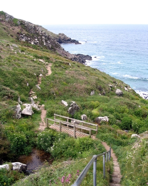
The footbridge crosses the stream that flows near Zennor, and then down into Pendour cove,
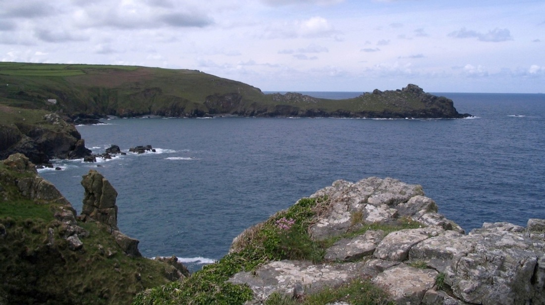
Still more rocky headlands, but the next major headland to the west is Gurnards Head.

|
|
Gurnards Head.
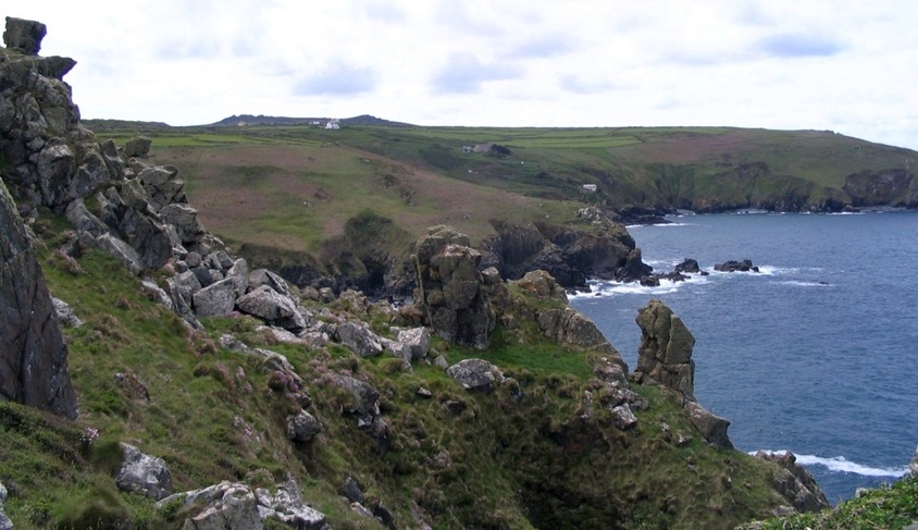
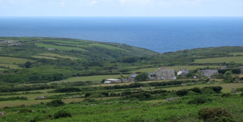
From Zennor Head the South West Coast Path heads roughly eastwards towards St Ives along the cliff tops, or just inland. But it's the same tale of an inhospitable coastline, with dangerous cliffs and rocks, that we've been hearing ever since Cape Cornwall. There are no harbours, and the shoreline is mostly inaccessible.
But the sea is also visible from the main coast road, especially if you catch one of the open-top Cornwall Explorer buses. These are a couple of views between Zennor and St Ives.
But the sea is also visible from the main coast road, especially if you catch one of the open-top Cornwall Explorer buses. These are a couple of views between Zennor and St Ives.
The Atlantic or the Celtic Sea (between Cornwall and Ireland) - you choose. 23.06.2011.
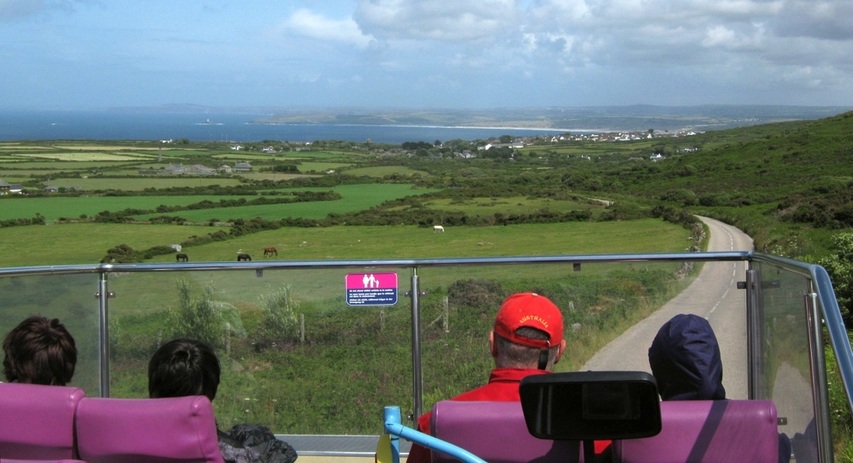
The bus begins to descend to the outskirts of St Ives. The nearest stretch of sea is St Ive's Bay. 16.06.2011.
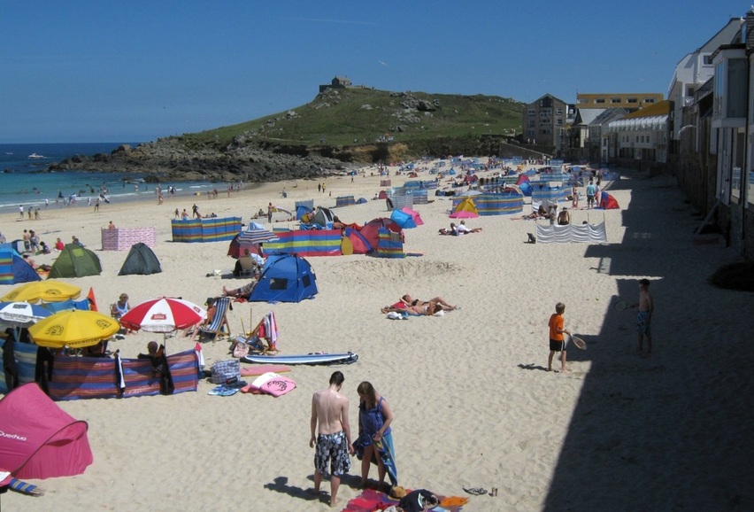
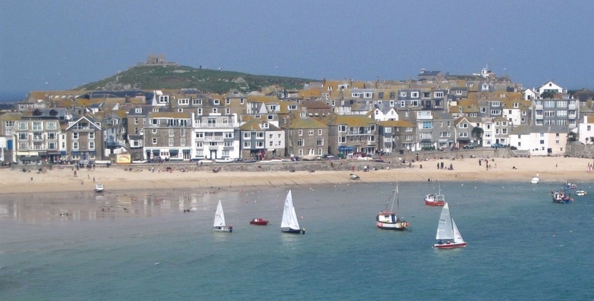
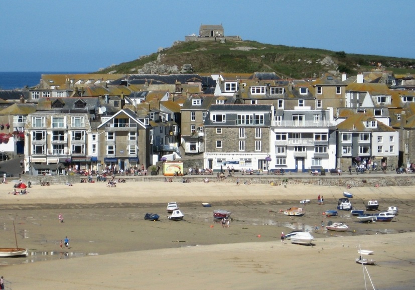
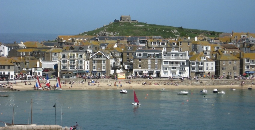
If you stay on the bus, your first view of the harbour at St Ives will be from the bus station, and a very fine view it is, as the bus station is quite high up. But if you arrive via the coastal footpath, then your first sight will be of Porthmeor beach, well known for surfing. (Photos 27.07.2011.)
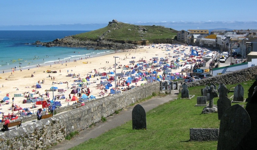
Porthmeor beach, but not much surf today.
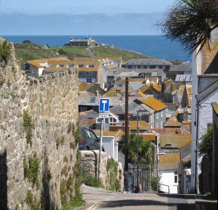
Behind the beach is The Island, or St Ives Head, with the old chapel of St Nicholas on it.
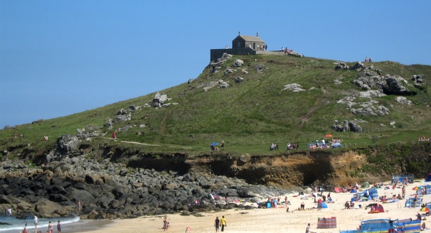
The Chapel of St Nicholas was originally used by fishermen. It was partially demolished in 1904, but rebuilt in 1911.
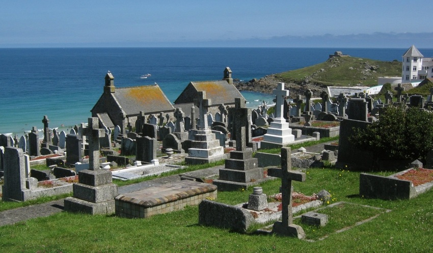
St Ives cemetery probably has one of the best views in the country!
St Ives is well-known for its arts colonies, which included some big names like Bernard Leach and Barbara Hepworth. But I am more drawn to a primitive painter and seaman Alfred Wallis, who is buried in a grave shown in the picture above, and in detail below:
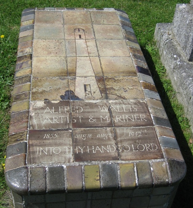
"An elaborate gravestone, depicting a tiny mariner at the foot of a huge lighthouse – a popular motif in Wallis' paintings
– was made from tiles by the potter Bernard Leach and covers Wallis' tomb"
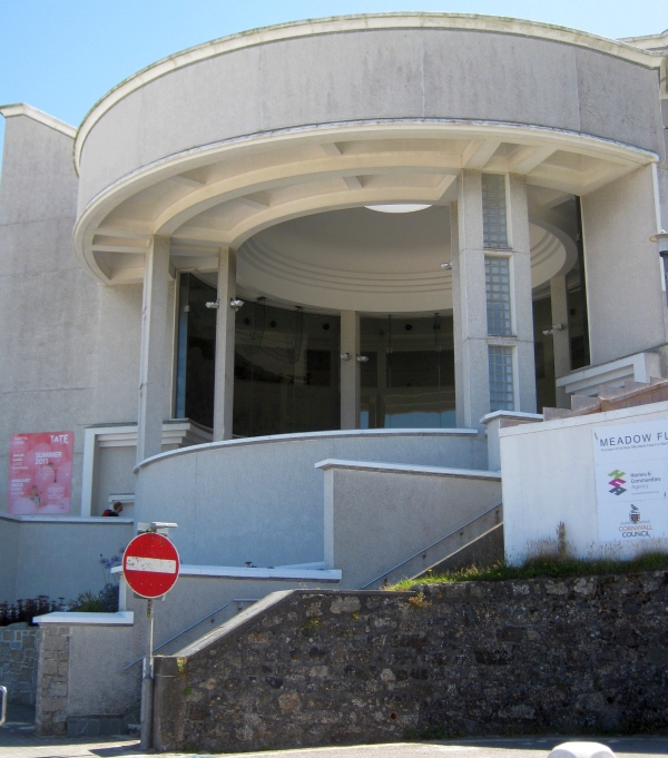
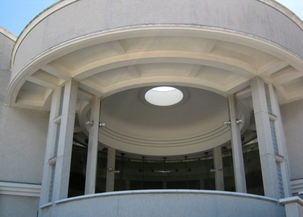
The Tate St Ives art gallery also overlooks Porthmeor beach - it's just east of the cemetery.
– was made from tiles by the potter Bernard Leach and covers Wallis' tomb"
The Tate St Ives art gallery also overlooks Porthmeor beach - it's just east of the cemetery.
|
|
Moving from Porthmeor towards St Ives harbour gives this view of the old Coastguard station on the other side of The Island.
HM Coastguard abandoned the station here in the 1990s. From 1999 it has been run by the voluntary group NCI St Ives.
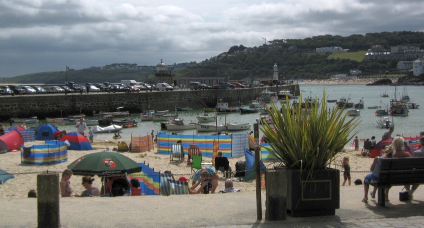
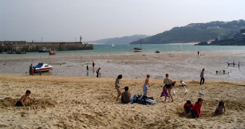
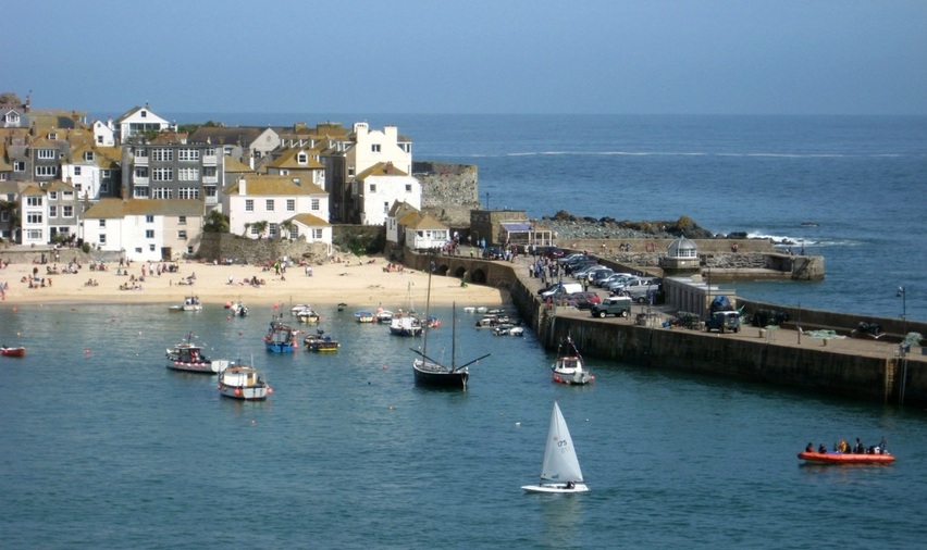
The harbour, seen near high water, is a large, drying beach, protected by a breakwater. The beach is more sheltered than Porthmeor. 10.08.2011.
St Ives was originally a fishing harbour, catching pilchards which were largely exported to Catholic countries.The pier was designed and built by John Smeaton, whose most famous achievement was building the third Eddystone Lighthouse.
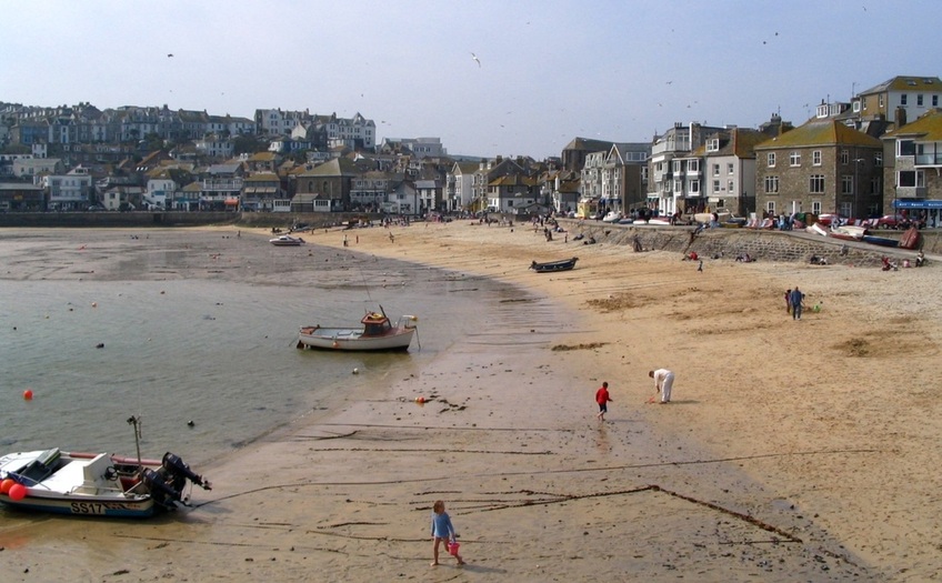
The harbour at low water. The beach behind the rocks is Porthminster. Beyond the end of the pier is Porth Kidney Sands. 02.04.2005.
Behind Porthminster Point, centre, is hidden another sandy beach, Carbis Bay. Port Kidney Sands run east to the entrance to Hayle Harbour.
St Ives harbour beach, seen from Smeaton's pier. The pier runs roughly north to south, sheltering this east-facing cove.. 02.04.2005.
This short stub of pier runs about SE from the north end of Smeaton's pier. In the hazy distance is Godrevy Island lighthouse. 03.04.2005.
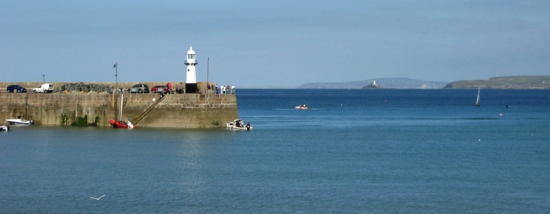
St Ives harbour light. The view is to the NE, extending beyond Godrevy Island LH to St Agnes Head, 14 M away. 15.09.2007.
Now it's time to head uphill to the bus station for some views from there...
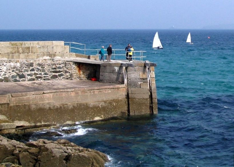
A panoramic view from the West Pier to Smeatons pier, near high tide. 02.05.2009.
A view from St Nicholas Chapel to the harbour light. The lifeboat station is at the shore end of the west pier, seen left. 02.05.2009.
The tide is dropping away from high water, and the sands are starting to uncover. 29.09.2005.
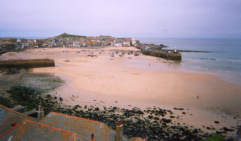
Low tide. 15.09.2007.
St Ives harbour at Low Water Springs - completely dried out. (Note low lying breakwater (?) extending SE.) 15.09.2007.
Another low tide view from a few years earlier: 2004
Just after high tide. A cornish lugger is moored just north of the west pier. 02.05.2009.
The east side of the harbour. Note another Cornish lugger, an echo of the port's fishing years. 02.05.2009.
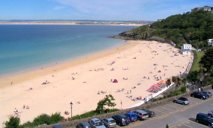
Just south of the bus station, there's a view SE, over Porthminster beach, to Hayle Towans, an area of sand dunes. It's nearly low water. 06.06.2006.
The railway comes to St Ives under the bridge just visible on the slope of Porthminster Point. The station is just inland of the north end of the beach. The branch line runs along the coast of St Ives bay and then follows the shore of Lelant Saltings, a shallow part of Hayle harbour, reaching St Erth and then Penzance.
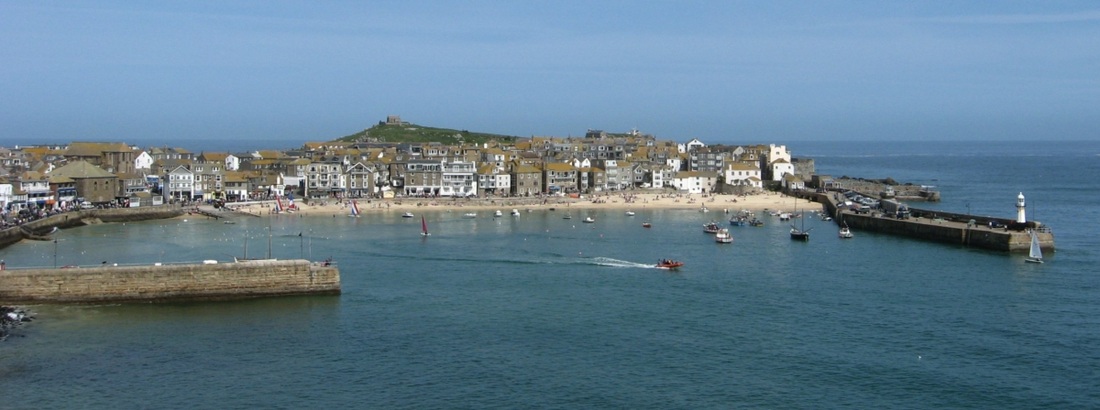
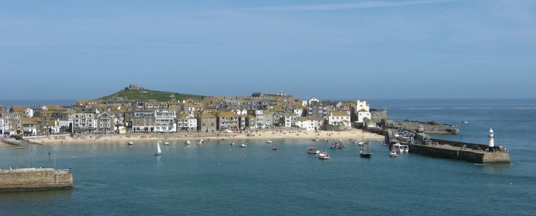
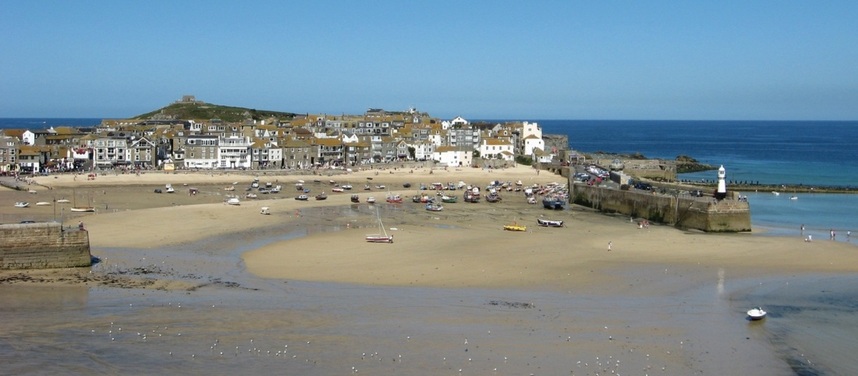
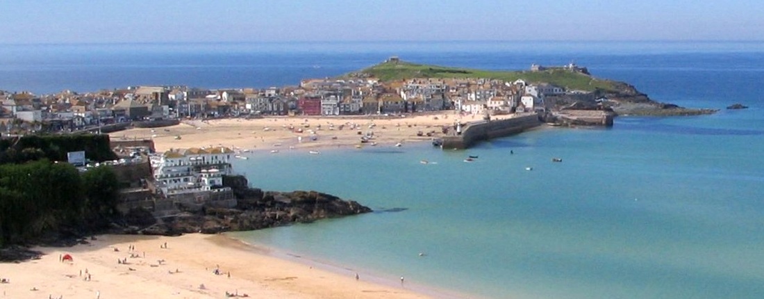
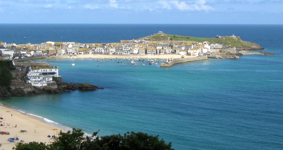
Finally we look back over Porthminster beach to the harbour of St Ives. These two pictures look similar, but there are differences. Most obviously, the tide is low in one, and high in the other. They were both taken in June, but five years apart. (Some of the buildings have changed colour schemes!) And the light is different; the first photo was taken in the afternoon, the second one in the morning. The viewpoints are slightly different too, in both position and height.
Finally we look back over Porthminster beach to the harbour of St Ives. These two pictures look similar, but there are differences. Most obviously, the tide is low in one, and high in the other. They were both taken in June, but five years apart. (Some of the buildings have changed colour schemes!) And the light is different; the first photo was taken in the afternoon, the second one in the morning. The viewpoints are slightly different too, in both position and height.
Porthmeor beach is on the other side of the isthmus, hidden by the buildings on the left. 04.06.2006.
The prominent hotel on the left is the Pedn Olva, named for the rocky promontory it stands on. 23.06.2011.
